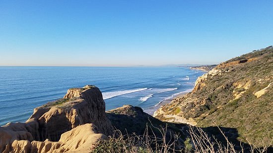
4.5Torrey Pines State Natural Reserve(3.788 reviews) - Best hike ever! Friday: 7:15 AM - 7:00 PM Spent More than 3 hours State Parks • Nature & Wildlife Areas • Hiking Trails
Although this park is located within San Diego's city limits, it remains one of the wildest landscapes along the Southern California coast, with miles of unspoiled beaches, chaparral, elegant Torrey Pine trees and a lagoon vital to many species of migrating birds.See more..
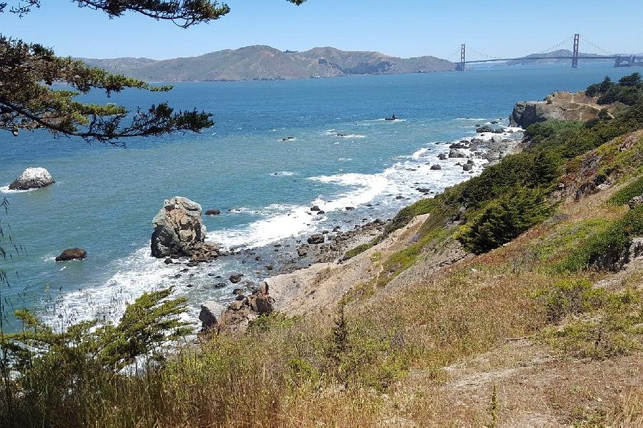
4.5Lands End(2.866 reviews) - Scenic hike along the coast with stunning views Friday: 9:00 AM - 5:00 PM Hiking Trails
At the northwestern corner of San Francisco, there is a series of stunning views at every turn in this wild and windy trail. Hillsides of cypress and wildflowers, views of shipwrecks and access to the ruins of Sutro baths, a San Francisco specials memory.See more..
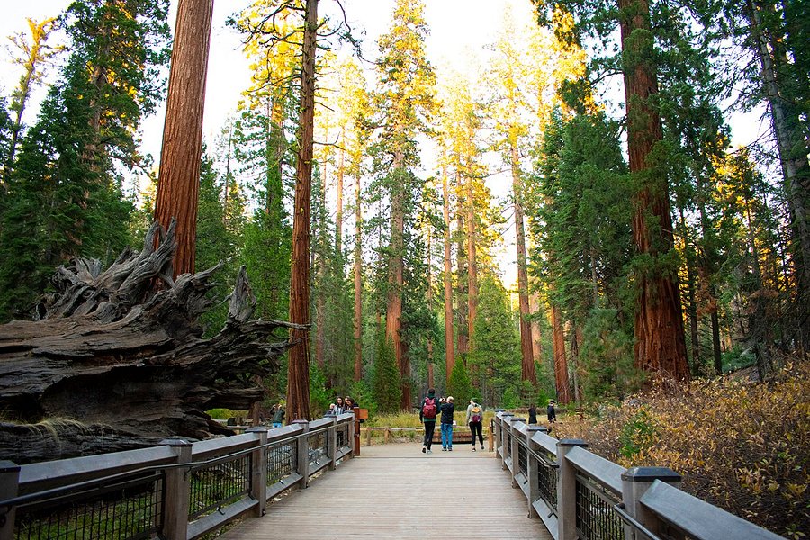
We loved our visit to the mariposa grove. Outside of Muir Woods in CA, this was our first visit to a large grove and it was really breathtaking. Most folks on tours or visiting only go on the shorter trail. Take the long trail and see the trees around the upper grove. We would have hiked more, but missed a few shortcuts we could have taken on perimeter trails They could use some better maps to show how the short cuts will save you time, especially for folks that dont want longer hikes. Fantastic views for us with fantastic weather!See more..
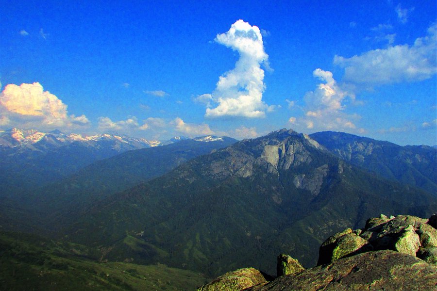
5.0Moro Rock Trail(1.568 reviews) - Great Experience Friday: 12:00 AM - 11:59 PM Spent 1-2 hours Hiking Trails • Geologic Formations
A challenging walk up 400 steps to a spectacular view.See more..
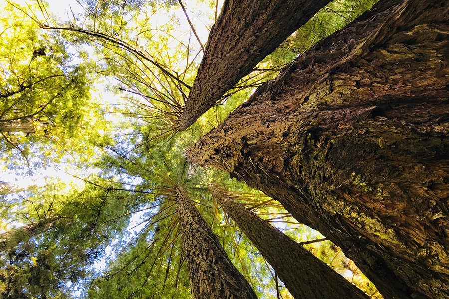
5.0Redwood National Park(1.158 reviews) - Amazing 2 day trip State Parks • National Parks • Hiking Trails
This massive natural reservation, located on the scenic coastline of Northern California, consists of nearly 140,000 acres of stunning redwood rainforest. It's a must-visit spot for nature lovers who enjoy camping, fishing, and hiking. There are multiple trails to explore the park's many wonders, from its majestic sequoias and towering Douglas firs to the stunning Lady Bird Johnson Grove. You might even spot wildlife like the majestic Roosevelt elk and the colorful banana slug. The best time to visit is in summer—make sure to pack layers as it can get chilly. Admission to the park is free, but the three state parks within the park charge a day-use fee. – TripadvisorSee more..
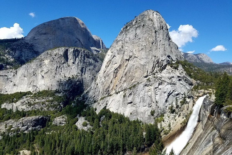
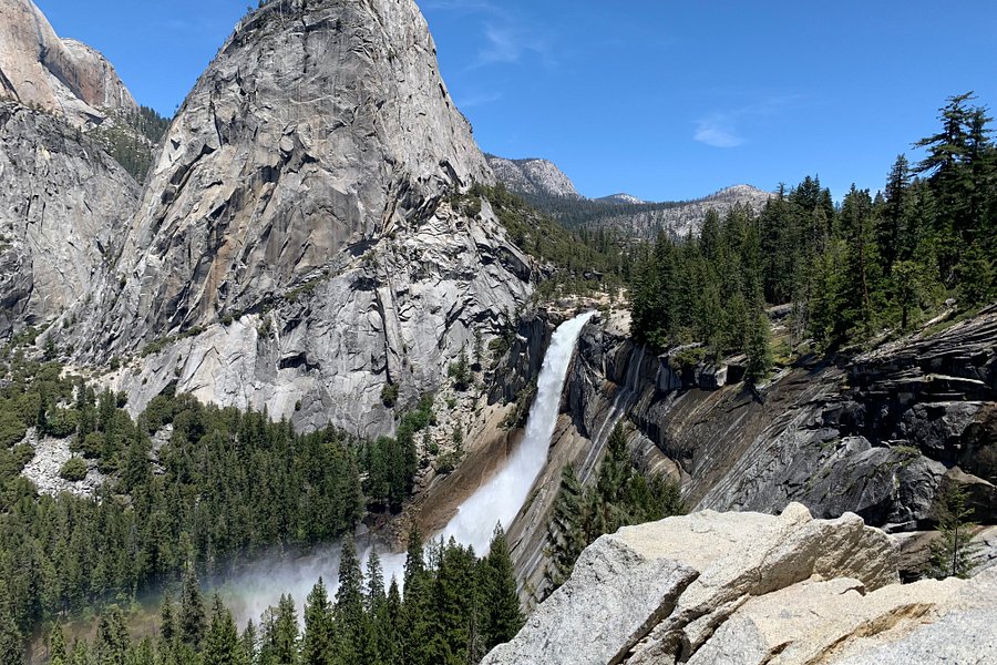
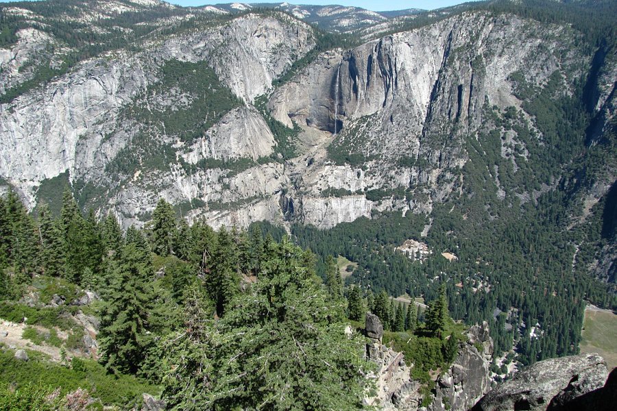
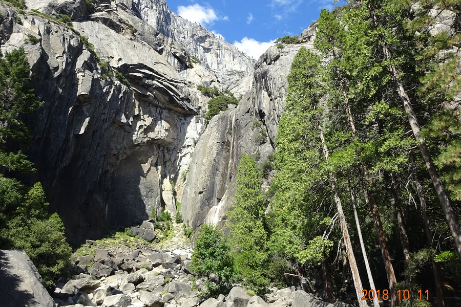
5.0Mist Trail(1.042 reviews) - There is water on the way up Hiking Trails
Eminently accessible and popular, the Mist Trail takes hikers through Yosemite National Park to Vernal Fall Bridge, the best place to watch the waterfall.See more..
Nice short hike from the parking lot. Multiple things to see on the trail including a cabin , a tree that you can walk through and the General Grant of course. The only drawback at this time was that the drive between general Sherman and General Grant is about 33 files properly and on top of that there is roadwork being done. Going to the General Grant We had a delay of 30 minutes in coming back there was a delay of an hour. It looks like they’ll be Repaving the road for quite some time. You could be one of the lucky ones to squeeze by before they stop you. See more..
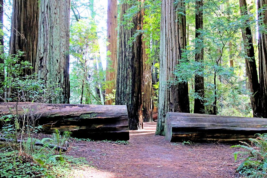
5.0Stout Grove(746 reviews) - Very Nice Trail Nature & Wildlife Areas • Hiking Trails
This area is separated from the bulk of the Redwood National Park. It’s definitely worth the extra drive time, though, and is easy to find. The last few miles of the drive to the trailhead are on a dirt road. People park everywhere but the parking lot is fairly large. I recommend driving to the parking lot first to see if there are any spaces before parking elsewhere. The hike is pretty short (less than a mile):and is easy. The area is very scenic as it consists primarily of ferns and redwoods. There are few non-Redwood trees in the area. The bulk of the trail is a loop. Pay attention to the signage when you enter the loop. There is a similar sign elsewhere on the trail which caused us (and a lot of other people) to mistakenly take a wrong trail. Highly recommended.See more..
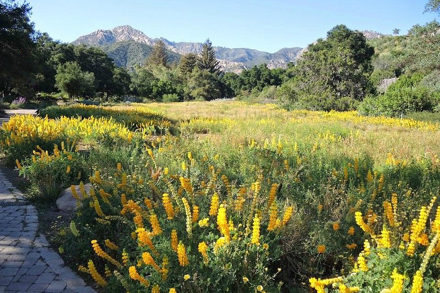
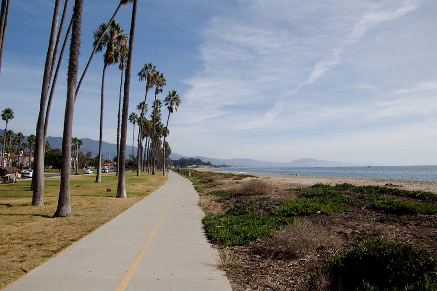
4.0Santa Barbara Botanic Garden(683 reviews) - Worth the visit! Friday: 10:00 AM - 5:00 PM Spent 1-2 hours Nature & Wildlife Areas • Hiking Trails
With sweeping views to the Santa Ynez Mountains and the Santa Barbara Channel Islands and stunning landscapes, the Santa Barbara Botanic Garden is a great place to explore California's native plant diversity. The Garden's 78 acres encompass a variety of cultivated displays as well as stands of natural coast live oak and riparian woodlands. The Santa Barbara Botanic Garden fosters the conservation of California's native plants through our gardens, research and education, and serves as a role model of sustainable practices. Explore 5.5 miles of trails and see the Redwood grove, iconic Meadow display, authentic Japanese tea house, Mission Creek, and so much more. Our capacity is currently limited on-site to allow for social distancing and we reserve the right to temporarily halt admissions during peak visitation times. Visit on weekdays and after 2 p.m. for the smallest crowds. Last admission is at 4:30 p.m.See more..
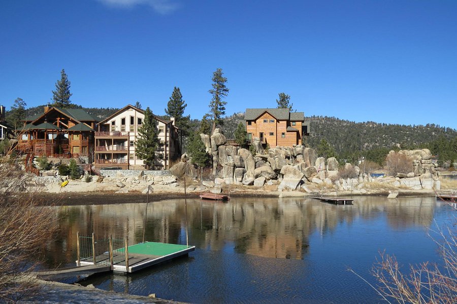
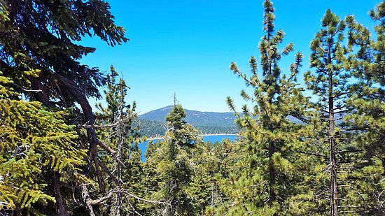
4.5Big Bear Lake(681 reviews) - No restrooms but great shops! Bodies of Water • Hiking Trails • Ski & Snowboard Areas
Big bear lake is beautiful and Idyllic town, however bathrooms can be very scarce. No one really offers Public restrooms so it is something that you should keep in mind. Also this was a last minute trip so I prepared to pay a lot for a hotel and lodging. But in general this is a place you want to book early because it does fill up very quickly especially in the winter time and especially around holidays. To give you an example of what the prices were ranging in December 2021 I paid $800 for a Motel six. That was for two nights well other hotels were averaging $3000 for two nights. Amazing little local shops are great including the fact that they have a lot of tire repair facilities around because my tire pressure was low coming up from Chula Vista where the temperature was much warmer.See more..
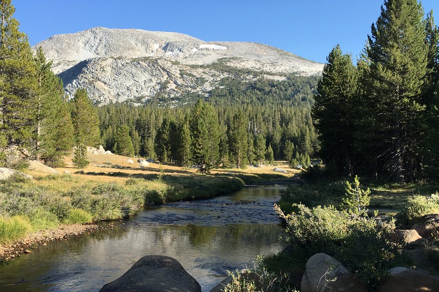
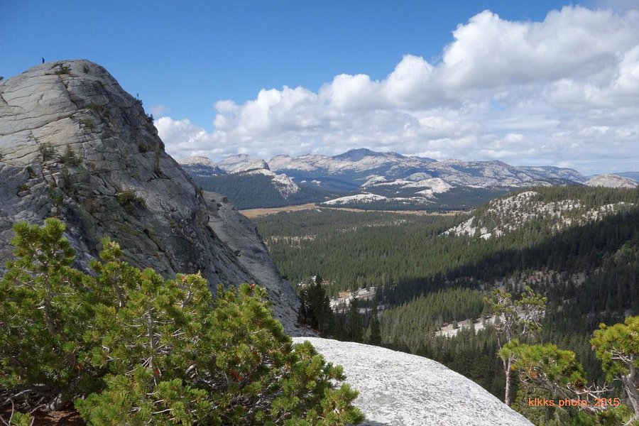
4.5Tuolumne Meadows(561 reviews) - All buttoned up Hiking Trails
A good place for hiking to get away from the crowds.See more..
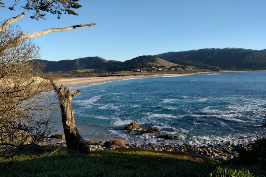
Having visited Carmel a few times, we finally visited Scenic Road. To get there take Ocean Road towards the Carmel Beach Boardwalk and then make a left on Scenic Road. It was a one way road that ended at the Carmel River Beach. The drive started in a typical residential neighborhood until it opened up on the right side with views of the Pacific Ocean. We found lots of parking as we drove and periodically got out to walk along the well maintained and paved path. Less people here so good social distancing was maintained compared to Ocean Avenue. Small beaches appeared as well as rocky points with waves crashing. Monterey pine trees lined the roadways but some of the multimillion dollar homes caught our attention. Certainly built to enjoy the maximum viewing of the ocean and salty air. Some were tiny cottages while others were mansions. Well worth the side trip if you have time.See more..
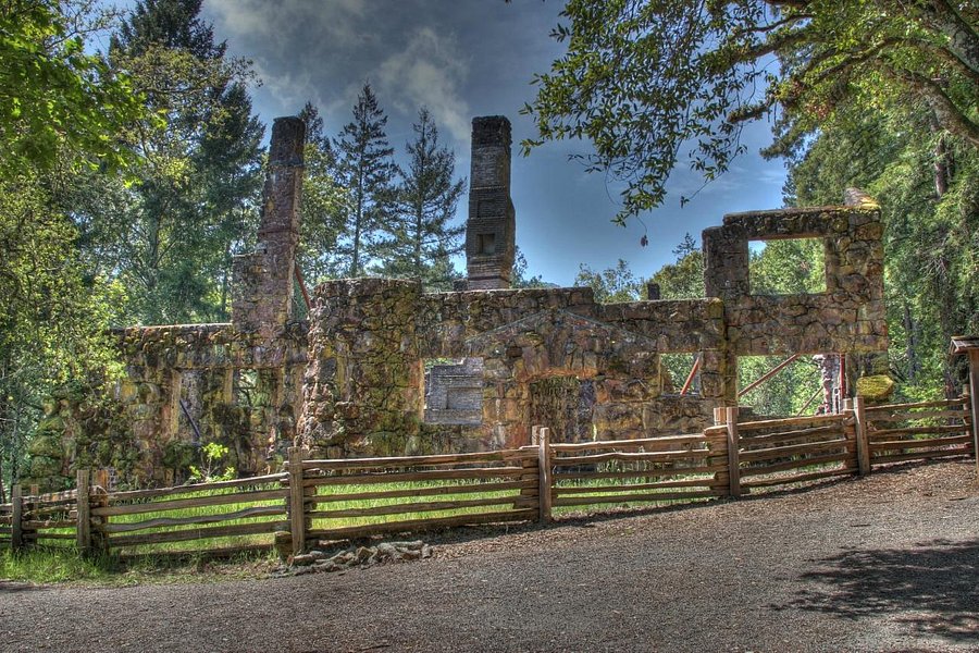
4.5Jack London State Historic Park(483 reviews) - Self-guided tour of Jack London’s property Friday: 9:00 AM - 5:00 PM Spent 2-3 hours Historic Sites • Parks • Hiking Trails
Jack London State Historic Park, comprised of 1400 acres, is the legacy of Jack London, one of America's most famous authors. The park offers historic buildings dating to the late 1870's, great scenic beauty and more than 20 miles of trails open to hikers, bikers and horseback riders. The park is open year-round, 7 days, 9 a.m. - 5 p.m. There is no camping. Day Use fee is $10/car. Historic buildings include the House of Happy Walls, the Wolf House Ruin, barns, the Cottage where Jack London lived and died and the famous "Pig Palace".See more..
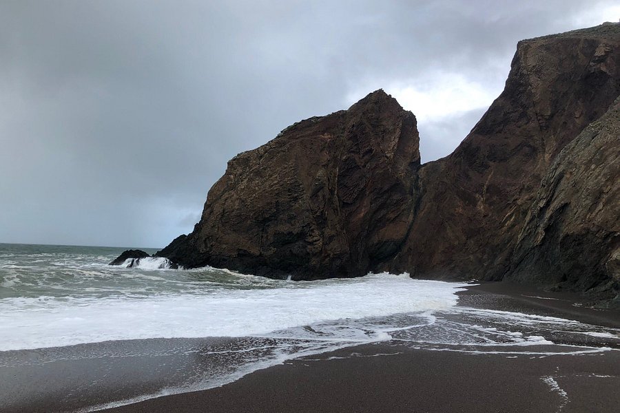
This is a wonderful preserve. If you want a nice seaside stroll you can keep to the boardwalk near the ocean. Sometimes it is windy. It is always beautiful. If you want a hike, take the seaside trail and then make your way up the hill into the woods. It is vey magical there. We have run into deer that last two times and there are other surprises too. Stay on the trails as there is a lot of poison oak. In the wet season some of the ravines are pretty wet so some good boots can come in handy. The trails are not well marked, but you can find your way around easily enough from the views. There is no way you could get truly lost, because you have Highway 1, the ocean, and two neighborhoods surrounding the preserve.See more..
We thoroughly enjoyed this memorable hike. Please read through a number of previous reviewers with great tips...they helped us immensely in preparing for a great hike. The keys: Leave extra early (it really pays off). If there is a decent waterfall during the time of year you go, pack hooded rain jackets to put on for the slippery steps area up to Vernal Falls. A picnic lunch at the top of the first set of Falls is a great treat. Many people do not continue on to Nevada Falls, as it's very steep and takes endurance after making the first trek...but oh so worth it. And I too, highly recommend taking the John Muir trail on the way back down for great views you don't get on the way up the other two trails. This hike will definitely be one of the best in our lifetime!See more..
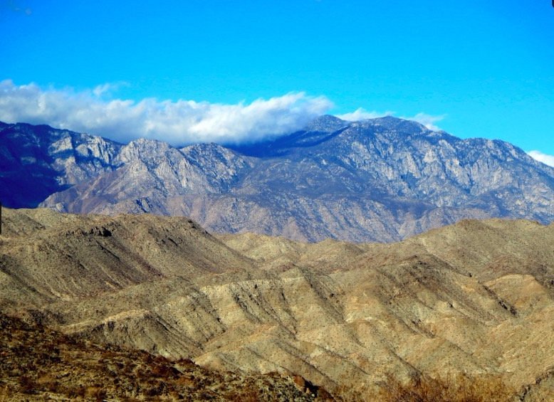
We had a late flight so took advantage of a beautiful fall day (temps in the high 60's) and visited Indian Canyons. We did the Andreas Canyon 1 mi hike and Palm Canyon/Victor Trail/Fern Canyon hikes. We visited the Trading Post and bought water & soda ($3 total). Overall really enjoyed our visit and felt the entrance fee was really reasonable for the time we spent exploring.See more..
4.5Bump and Grind Trail(327 reviews) - A feat of accomplishment, great views Hiking Trails
It took us 2 hours 15 minutes to complete the trail loop. We hiked counterclockwise and if I hiked it again, I would go clockwise. The ending part of the trail coming down was quite treacherous. I should have heeded the advice of others in the reviews that said go clockwise. It is a 4 mile hike and my legs were fatigued. We went early in the morning on a weekday and that was a good time to hike. If you love hiking, this trail is a feat of accomplishment!See more..
4.5Eagle Falls Trail(314 reviews) - Gorgeous hike with waterfall views Friday: 6:00 AM - 6:00 PM Hiking Trails
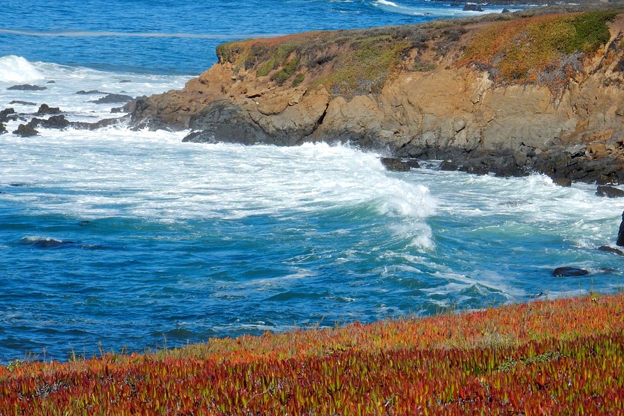
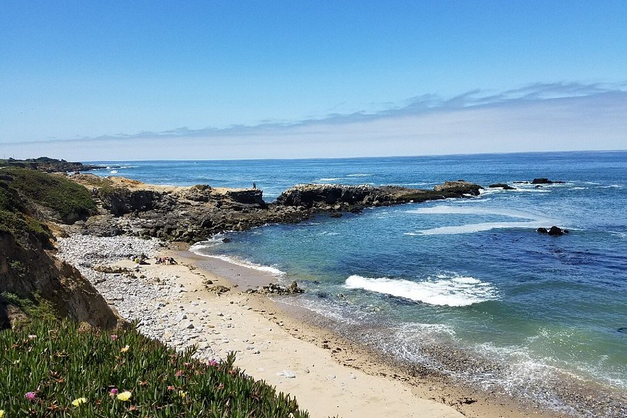
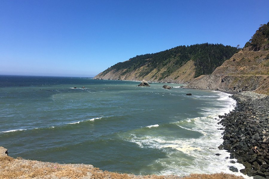
Easy and scenic hiking trail along the Pacific coast that measures six miles round trip.See more..
5.0Panorama Trail(293 reviews) - Go from Glacier Point to Nevada Falls instead of the reverse Hiking Trails
I have done this trail now twice, going once in each direction. While it is a fine trail, the route heading from Glacier Point to Nevada Falls definitely has the better views (and has the advantage of being net downward, though with some climbs after Illilouette Fall). Mostly this is a way to connect from Nevada Falls to Glacier Point, with a nice stop at the Illilouette for a snack. Note that the trip FROM Nevada Falls can be tricky as the turn off to Panorama Trail goes the opposite direction from which you are heading and is easily missed. If you have hit the ledge wall with great views of the falls, then you have gone too far!See more..
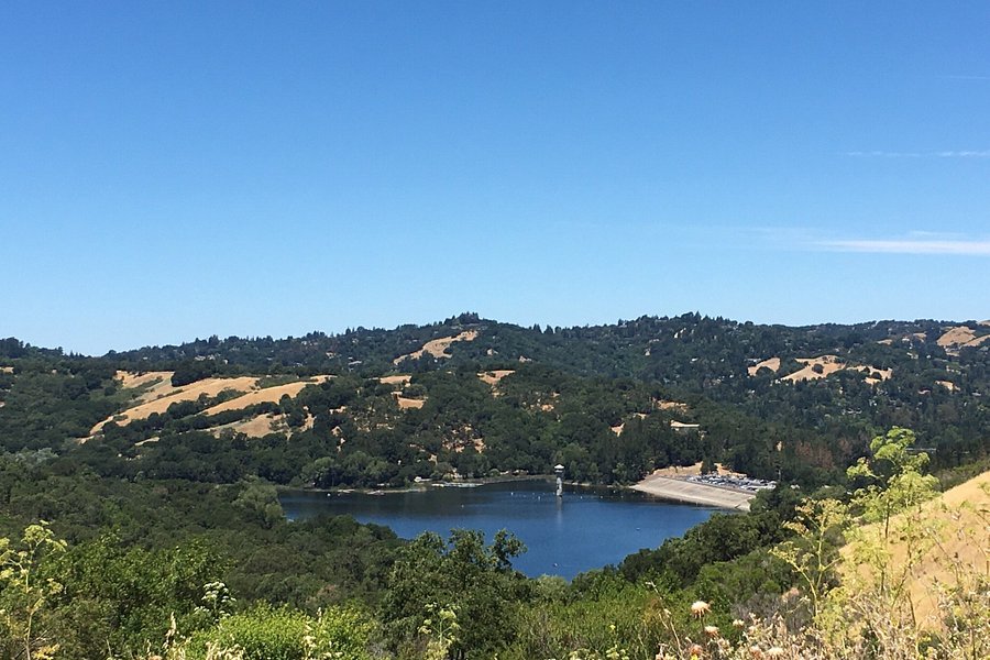
Well located in Lafayette. Lovely 5+ mile walk on a paved trail w/a view of the reservoir as you walk. Fishing, paddle boating are available.See more..
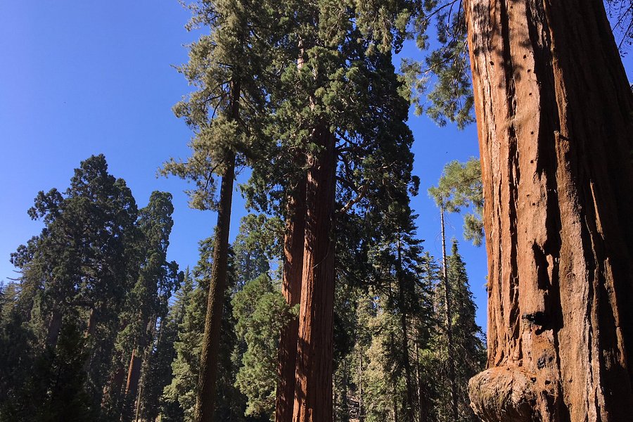
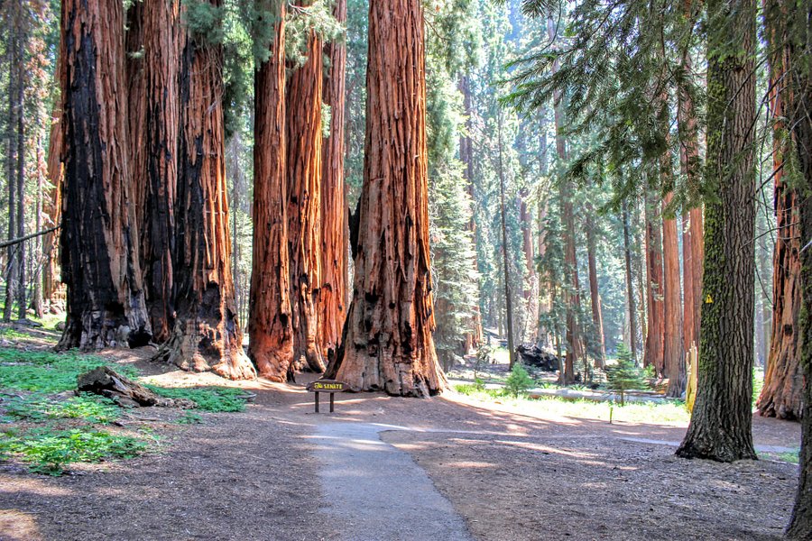
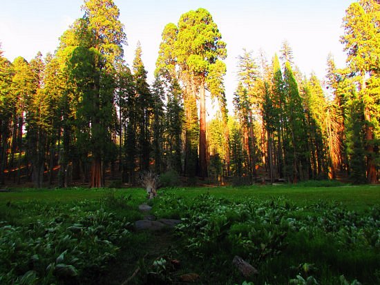
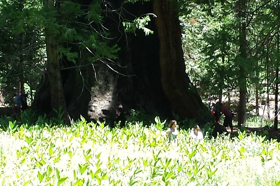
5.0Congress Trail(290 reviews) - The Reason You Come to Sequoia National Park Hiking Trails
This is the premier trail in the sequoias of the Giant's Forest. It starts at the foot of the biggest tree, General Sherman and goes off across a brook into the woods. When we went, the trail was partially packed snow and ice which made the walk much longer so we turned back before finishing the loop. However, we got to experience what is like walking in the presence of the biggest trees in the world. It is so unique and amazing whatever the conditions. It is the reason you come to Sequoia NP.See more..
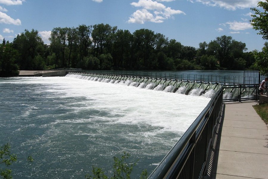
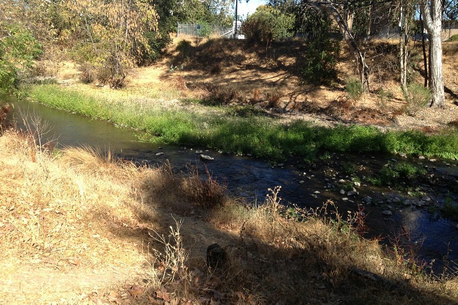
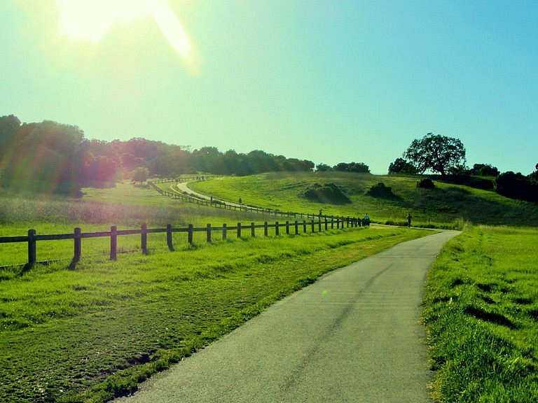
4.5Sacramento River Trail(283 reviews) - Great Outdoor Experience in Town! Hiking Trails
Designated as a National Recreation Trail by the U.S. National Park Service, this scenic trail offers hiking, biking and horseback riding within the boundaries of a lively city.See more..
We had a good time biking the path. The only downside is you can only go so far with the 4 man bikes. If you just plan on going one end to the other 2-3 hours is plenty of time. Also, its a little harder than you think.See more..
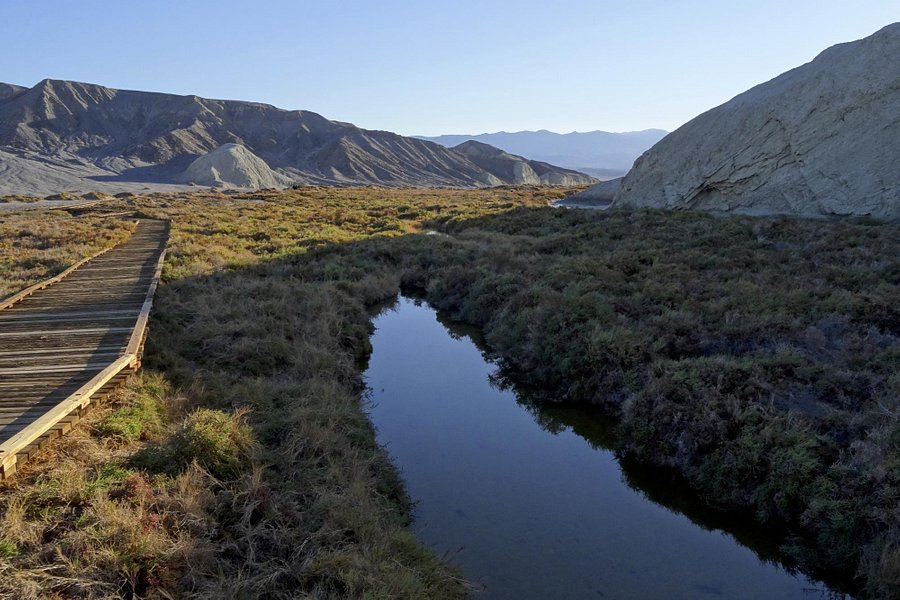
4.0Salt Creek Interpretive Trail(263 reviews) - Go see the pupfish Friday: 9:00 AM - 5:00 PM Spent 1-2 hours Bodies of Water • Hiking Trails
If you have any interest in wildlife, this is a must-see site in DVNP. The endangered Death Valley pupfish is easily visible from the boardwalk. I was able to get very good pictures with just my phone camera and even better ones with my DSLR camera. The site itself is located between Furnace Creek and Stovepipe Wells on an unpaved, but well maintained road (high clearance or 4x4 are not necessary).See more..
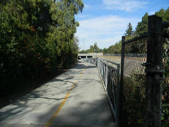
4.5Los Gatos Creek Trail(260 reviews) - Certain sections of the trail are very scenic Hiking Trails
Paved trail great for running: cuts through parks, ponds, and downtown Los Gatos.See more..
TIPS: Here are the reasons why you GO. It's NOT just another Redwood Trail. 1. It's along a ridgeline; most other redwood trails sit in valleys. 2. There are fewer low trees to block the high canopies. 3. It's well off the highway - no traffic noise. 4. The higher ridge setting tends to get more the fog -thus stunning misty transcendental photographs. 5. The arched bridge crossing makes a nice walk even greater. I'd kiss Lady Bird if I could. I loved it here!See more..
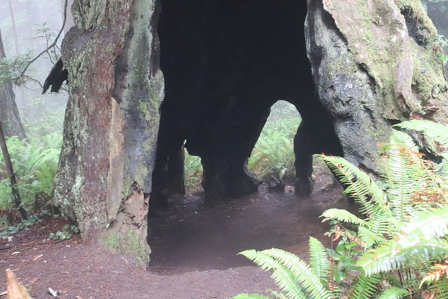
Easy hiking trail that takes you past the Chimney Tree and Tharp's Log.See more..
4.5Mt. Tallac Trail(241 reviews) - Wildflowers and scrambling Hiking Trails
About a two hour drive from Sacramento and easy to find trailhead. Parking area but soon is at capacity so get there early or park alongside the dirt road. Varied terrain with lovely wildflowers and lakes dotting the landscape makes for a wonderful adventure. The last couple of miles on the ascent you come across a false peak and then once over the rise, you have another mile to go. We shortcutted on the descent by literally sliding down the rocks but this is also a good way to sprain an ankle although we were fine. A good pair of shoes with excellent grip and ankle support is almost mandatory. Saw some kids swimming in Cathedral Lake and that makes a refreshing stop. No mosquitoes this time of year in July. Afternoon thunderstorms are an issue and I suggest summiting by noon at the latest or even earlier as you are on fully exposed rock on the way down for a couple of miles. Most hikers were wearing masks or at least held a buff to their face as we passed by so that was nice.See more..
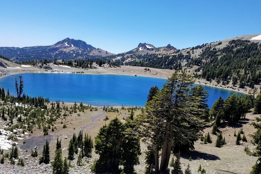
Lassen Volcanic NP is a national park with four volcanoes, including one that erupted in 1914. The hiking trails go to the hydrothermal features that are similar to those at Yellowstone like bubbling mud pits and sulphur pools. Others traverse a huge cinder cone from an eruption and other volcanic peaks. It’s an interesting and scenic park, and certainly lesser-known than Yellowstone and others. But it’s really hard to visit. The park road is closed half the year due to snow. Other areas are closed due to fire damage. This limits what you can see and where you can go in the Park. The Park itself is a 3 hour drive from Sacramento or Reno, which are themselves not easy to get to. There are five park entrances, only two of which are connected by the park road, meaning that unless you are backpacking, you have to drive many miles on mountain roads to see the whole park. So it will take multiple days to do the main hikes, but unless you are camping, there are no accommodations close by. I was able to see the view of Lassen Peak and some hydrothermal features and hike to Ridge Lake, and would like to return and see more, but I am not from the area, and a multi-day commitment is a lot for a Park whose most famous features are similar to those in other Parks.See more..
Summer temps at 61 degrees, sandy trails along the bluffs and paved pedestrian/bike path by the north end hotels. Excellent walking. This path crosses the Trestle Bridge over Pudding Creek so you can walk the entire length of town if you choose.See more..
4.5Castle Rock Trail(233 reviews) - Easy level one hike Hiking Trails
This was a level 1 hike. Very easy and scenic views are nice. But you have to stay on the trail or you might run into some wildlife. At the top there are lots of photo opportunities and resting stops. I would highly recommend it for kids also because my 4 year old made it up with easeSee more..
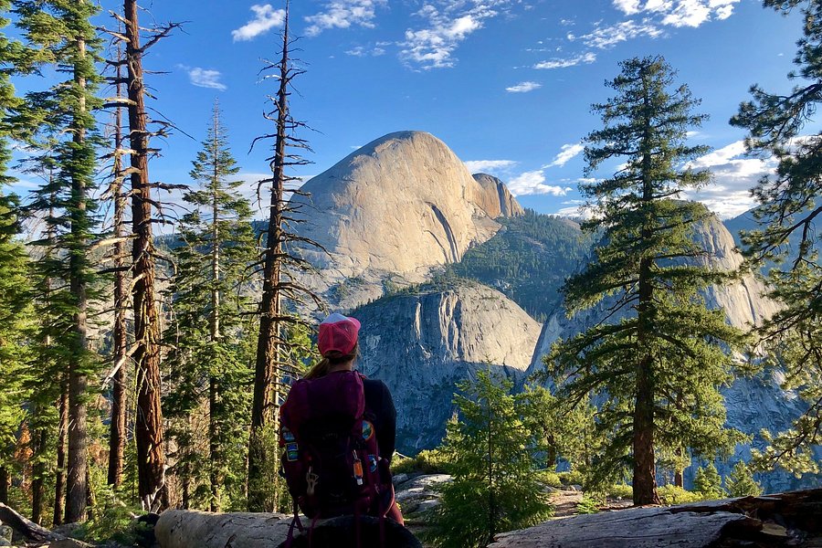
Hiked this morning at sunrise before the crowd after reading David S. review. 2hrs 20 not pushing hard at all (and carrying 10kg pack for conditioning) it’s easily doable. Two young guys passed me going up they got there in 1hr 40. Just pack water and snacks and maybe lekkie sticks for your knees coming down. This is one of the most rewarding hikes in Yosemite because of the amazing views enroute and at the Too. Also with the road closed there are none of the usual big crowds at Glacier Point. If you have time and the legs! another 4-5hrs will bring you back down to the valley via the panorama trail.See more..
I really enjoyed this walk with a friend. We were in the area and I thought it would be pleasant to walk the old piece of highway without being spectacular. Actually there is something quite spectacular about it. It’s evocative and a little bit eerie. Best of all was bumping into Eric the docent right at the beginning. He’s a treasure. A font of information and mischievous with it. Thanks Eric for making our day.See more..
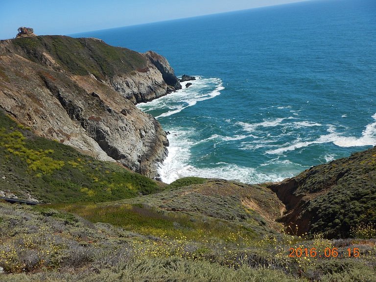
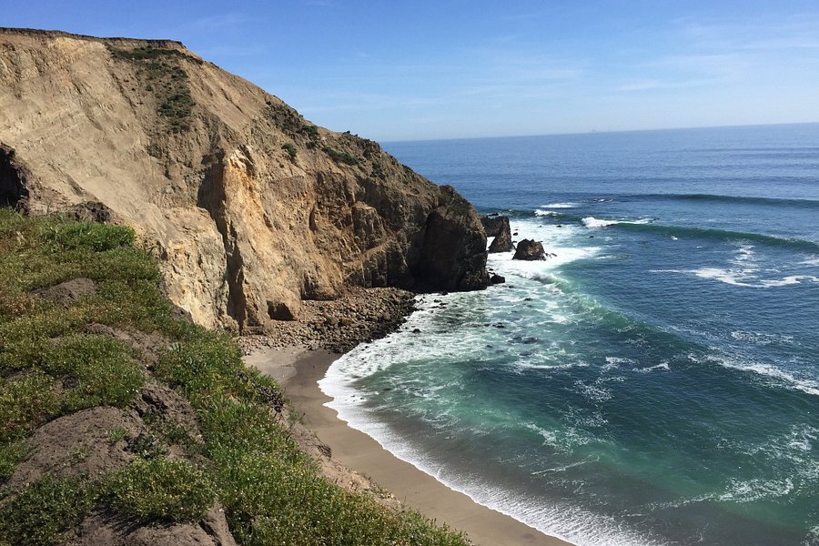
5.0Point Reyes Hiking Trails(195 reviews) - Very peaceful...just us and the seals! Friday: 6:00 AM - 12:00 AM Hiking Trails
Definitely worth the drive up from the East Bay on a weekday. We hiked the Chimney Rock trail, including the little spur out to the Elephant Seal Overlook. Very nice hike...maybe a couple of miles total. Mostly flat. We had great views of the beach to the south along the trail (be careful, it's precarious), and great views of the elephant seals (some were even fighting and making strange sounds)...very cool. Nice exhibits too about the lifeboat station. Only a couple of other people there. Definitely recommend!See more..
4.5Lower Yosemite Fall Trail(194 reviews) - Nice walking path to view the water falls and large trees Hiking Trails
You can access the Lower Yosemite Falls trail by multiple ways. A park shuttle bus stops at #6 and then you can walk to the falls. There are parking lots across the meadows and you can walk to the falls. Or you can park at the Visitor center and take the Yosemite loop trail to get to the falls. The path is a loop and it is pretty scenery as you walk towards the falls. There is a bridge that you can take pictures of the falls. We spotted a coyote who ran right in front of us and then seemed to hang out in the forested area for awhile. Unfortunately, too many people were crossing the "do not enter" area and walked up to the water fall spray. First it could be dangerous and slippery, plus it ruins photos for other people who are observing the signs. From some of the walk, you can view 3 waterfalls, so a nice area to visit. See more..
This is a fantastic day trip or overnight experience perfect for getting back to nature and taking in the fresh smells of the forest away from it all. This sight is a 1.3 mile paved path that takes you around the biggest redwoods you have ever seen. This stop should take about an hour to two hours to experience. Parking is 10 dollars unless you park 50 yards up from the trail entrance at the second pull in. There is a gift shop and public bathrooms availble. Know before you go: Kernville is the biggest town nearby which is an hour away If you are coming from a far away then Kernville is the best place to stay overnight. Get Gas!! There arent any places within an hour in each direction No cell phone coverage an hour in each direction of the site Very small winding roads (average speed 35 to 45 unless you are a crazy driver) Bring snacks and drinks there are a few places to eat about 30 mins away but priceySee more..
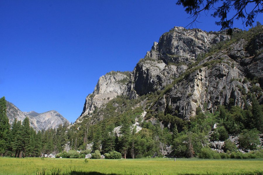
For some reason, Sequoia park is more popular and more visitors than Kings Canyon. If I have to choose either of these two parks, I will pick the Kings Canyon, and Zumwalt Meadow is one of the reasons. It reminds me the scenery in Yosemite! We just went to the trail head that is only 0.3 miles from the parking lot. You can take several postcard-quality photos there! Unfortunately, the trail was heavily covered with wild flowers (= weeds), and thus we decided not to complete the trail. From this trail head, you can also hike for 2 miles (one way) to the roaring river fall, which we actually did.See more..
4.5Panoramic Point(164 reviews) - You could easily miss this-but don't. Hiking Trails
Turn right just before you get to John Muir Lodge, down a little paved, unmarked road, that you wonder whether or not is the right road. The winding road takes you to Panoramic Point-an almost complete view of the mountains and valley-a true panorama. Nice picnic tables (we had lunch) rest rooms, newer paved trails to the top. (kinda steep but with switchbacks). And a beautiful view in front of you. We went during the day, but I'm betting this would be a great place to see the sunset or the stars. Kinda out of the way, but worth the time to find it.See more..
I have hiked on this trail twice, the last time, staying overnight at Pear Lake. It's a great hike. But if you are not in shape, then don't try it. It's a little tough. Uneven rocks on trail, consistent elevation climb, etc. ****PLEASE OBEY THE PARK RULES! Don't break trees to burn, pick up all litter in your campsite (even if it's not yours), never litter, never vandalize rocks or trees, never feed wildlife, don't approach wildlife, pack everything out that you brought in, no music (or very very low...I'm mean there is a reason you wanted to be in nature...not to listen to the same music you can listen to all the time!), and be quiet after 9 pm (others might be backpacking very early and it's respectful to be quiet)!! Thanks!See more..
4.5Lembert Dome(154 reviews) - Excellent, tough climb up to Lambert Dome with exceptional views from the Top Hiking Trails • Geologic Formations
Our first hike in Yosemite was up at Tuolumne area to Lambert Dome. We were by ourselves almost all the way up and then just a few folks at the Dome. What magnificent granite rock and views. Saw deer, but alas, no bears! I wanted to see one, but my wife, well, perhaps not.See more..
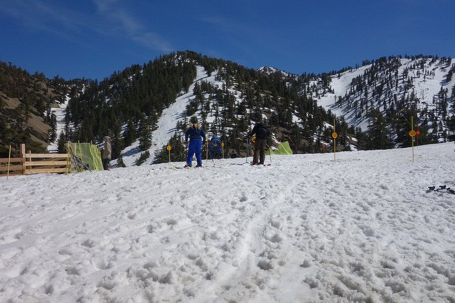
4.0Mt. Baldy Ski Area(152 reviews) - Small resort feel Friday: 7:00 AM - 7:00 PM Hiking Trails • Ski & Snowboard Areas
This popular California ski area offers more than 50 trails for downhill and snowboard enthusiasts.See more..
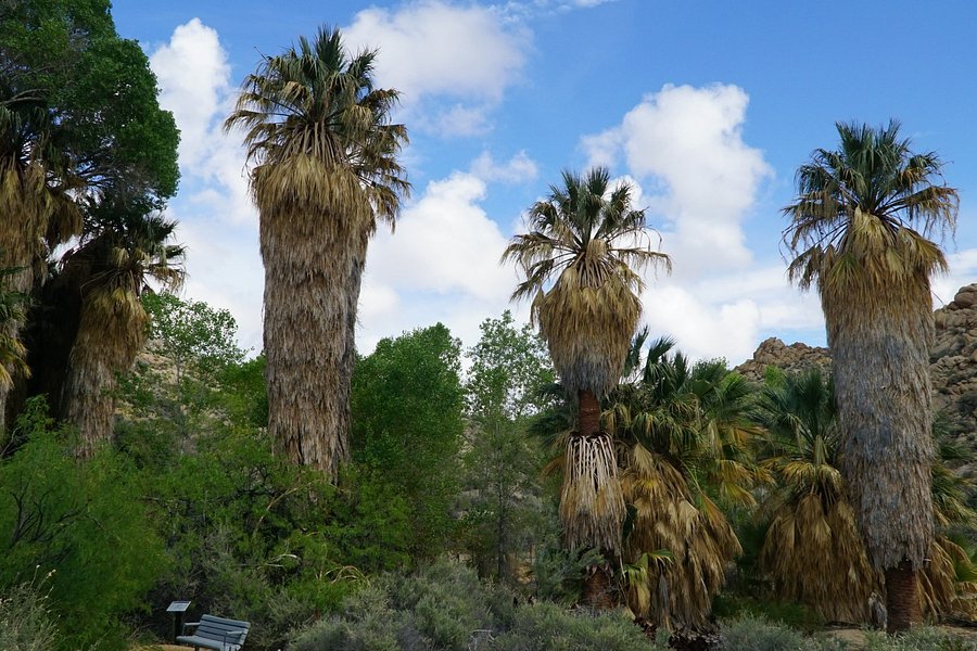
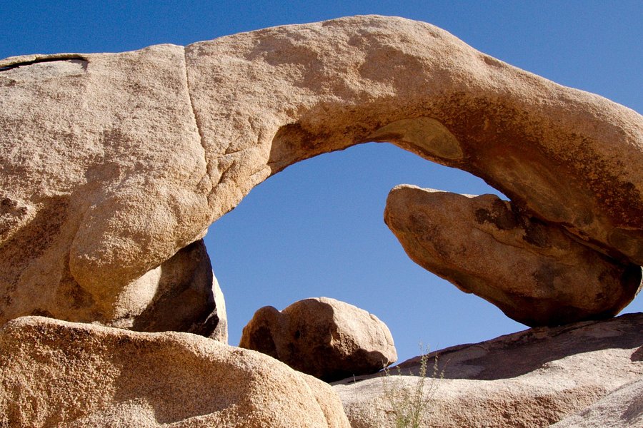
4.5Ryan Mountain(151 reviews) - Not an easy hike, but so worth it. Hiking Trails
Four mile hiking trail offering great views from the top.See more..
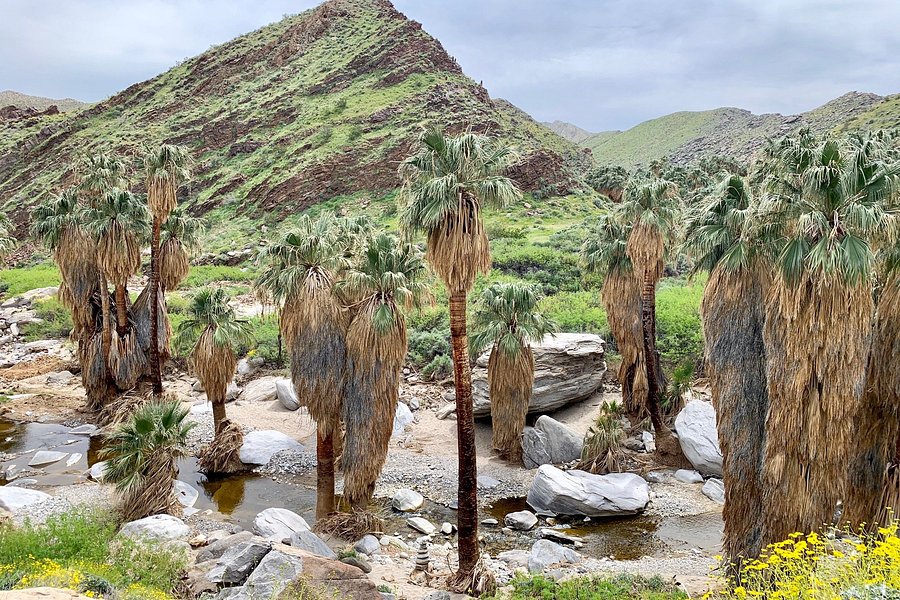
Thoroughly enjoyed this hike which exemplifies the beauty of the desert ~ dry, rocky, and rugged. It's technically not inside Joshua Tree National Park which is why the ranger recommended it. It wasn't crowded at all and has grand views of the valley. The hillsides are dotted with cacti and desert plants blooming through cracks in rocks. It's startling to see tall palm trees rise up in the distance as you hike through dry desert hills. We packed sandwiches and sat on huge boulders for a picnic lunch at the end of the trail. It's worth the strenuous hike to reach the secluded palm tree oasis by the spring! I'd rate this hike as moderately difficult due to the meandering dirt trail that becomes very rocky at times and there is hardly any shade. Wear hiking shoes, hats and bring adequate water. There are some steep parts that are not suited to the very young/old. Trails aren't marked very clearly and visitors can go off trail easily. Highly recommend hiking poles.See more..
My daughter & her young family lives 5-min walk away from this wonderful trail. Whenever I visit I’d take my grandchildren and walk/cycle for on this trail. With mild temperate climate and this outdoor pursuit...life is good ! Love the outdoors- looks this trail ...there’s miles of it and links many residential places is also a busy commuting corridor for many cyclists at peak hours! (google, shore line park etc) It is one of the better public amenities here under the beautiful blue CA sky! See more..
A friend recommended this place, and my spouse and I were grateful that he did. We were pleasantly surprised to find that it's not just one trail; it's a number of different trails. We took what I'm guessing was the main trail, which led us down to the beach. Very scenic and not very difficult. We were there on a weekday in early June and had no trouble parking. Our only regret is that we didn't have more time to spend here.See more..
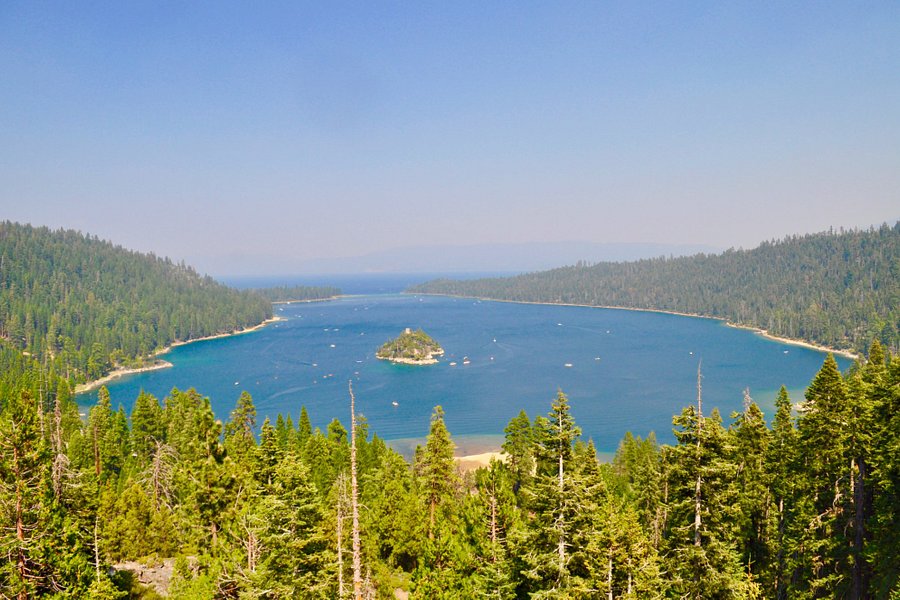
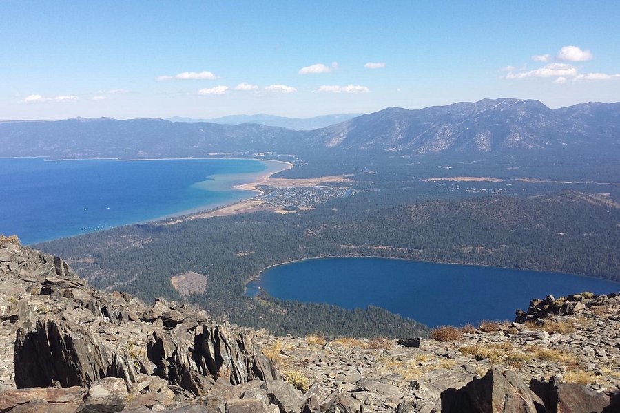
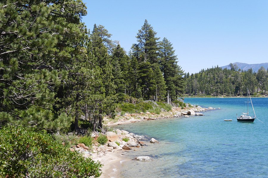
5.0Rubicon Trail(121 reviews) - One of the most gorgeous trails Spent More than 3 hours Hiking Trails
The Rubicon Trail is one of the best long trails in the Lake Tahoe area. The hike could start from Eagle Point in Emerald Bay State Park and go all the way to Calawee Cove in the north over a distance of about 7 miles (oneway). The trail wraps around the Emerald Bay and provides gorgeous views of Lake Tahoe the whole way. There are several intermediate access points to get on the trail. Water is available at campgrounds along the trail, though it is insurance to carry water, especially on hot days. The trail is very well maintained and easy to follow. At the north end there is an alternate trail that goes by the old lighthouse; be aware that this section is a pretty steep climb. Even just a small part of the Rubicon Trail should be on the 'must do list' for any nature lover. It is an awesome trail with breathtaking views of Lake Tahoe.See more..
boulder this boulder that Amazing place for hikers and climbers a must see must do most awesome place on earth Beyond beautiful Hiking Trails and routes are so interesting and beautiful. We did many trails in one day from morning to evening. The Joshua Trees and other wildlife is so special here. Sun rise and sun set is a must see desert beyond goodSee more..