4.0Ancestor Square(66 reviews) - Great stop while touring around St George Historic Sites • Points of Interest & Landmarks • Scenic Walking Areas
Nice little relax walk thru the Square. Plenty of restaurants and historic stops. Good central area to all of downtown. This is touring at your leisure yourself..Free parking.See more..
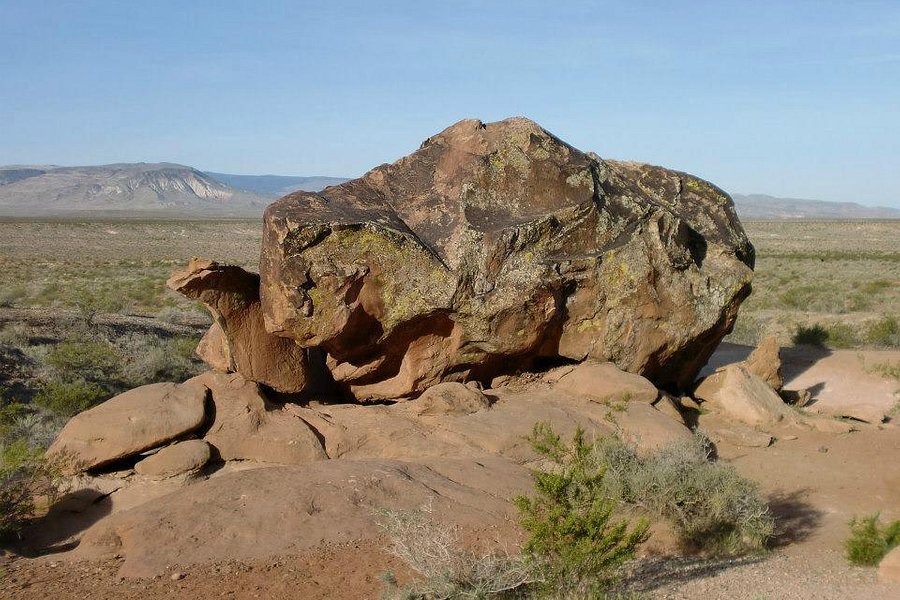
4.5Little Black Mountain Petroglyph Site(43 reviews) - Petroglyph boulders Spent 1-2 hours Nature & Wildlife Areas • Hiking Trails • Scenic Walking Areas
Nice grouping of petroglyphs on large boulders. Along a dirt road that was easily accessible in a stock Jeep Cherokee. About an 35 minutes from St George. Site has a pit toilet and shaded picnic table. A gravel path takes you past several petroglyphs quite close to the parking area.See more..
4.5Silver Lake(40 reviews) - Gorgeous Vistas, Great Hiking! Spent 2-3 hours Nature & Wildlife Areas • Hiking Trails • Scenic Walking Areas
The drive up Big Cottonwood Canyon was amazing, but the spectacular views hiking in the Brighton area were nothing short of majestic! On a lovely September afternoon, we warmed up with the easy, picturesque hike loop around Silver Lake. The majority of the loop is a boardwalk, with benches and lake outlooks. It was very peaceful and relaxing. Then a short parking lot drive away the real hiking begins! The temperature was perfect for the strenuous, uphill hikes to Lakes Mary, Martha and Catherine. For a Kansan, hiking at the altitude of 8,500 - 10,000 feet was challenging! Taking breaks to catch our breath, and to take lots of photos, it took us about three hours to hike to the lakes and back. Lake Mary is absolutely gorgeous! We saw numerous adorable chipmunks and one moose. There are other trails in this area, and we can't wait to return to Utah, so that we can do more hiking in the Wasatch Mountains. See more..
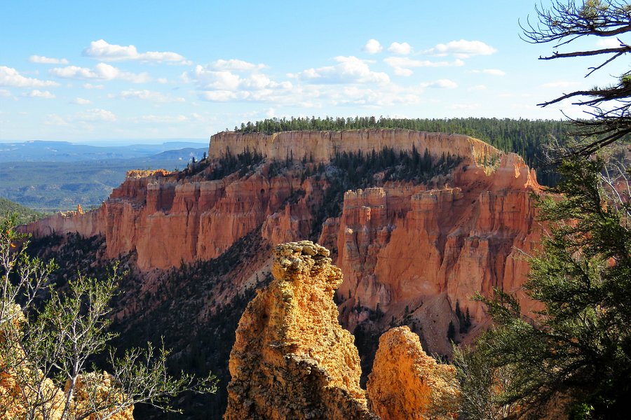
4.0Paria View(26 reviews) - can take a look if you drive along Spent < 1 hour Lookouts • Scenic Walking Areas
There is not much people in this point may be due to not accessible by shuttle, we get there by our car. We need to walk a few minutes to the view point after parking the car, the elevation here is 8175 feet. We can see some hoodoos view there, but it’s less beautiful then in the Bryce point, so if you don’t have time, then go to Bryce point and skip this point is fine.See more..
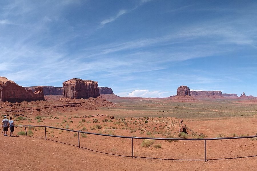
5.0Artist’s Point(9 reviews) - One of the prettiest stops Points of Interest & Landmarks • Lookouts • Scenic Walking Areas
Artist's Point (now named Navajo Code Talker Point) is one of the nicest stops on the Valley Drive. You can look out over much of the valley. See more..
4.0Sego Valley(1 review) - Pretty Area Points of Interest & Landmarks • Lookouts • Scenic Walking Areas
This area is a ghost town but so pretty. You really get a feel for what it would have been like to be one of the first people in the area.See more..
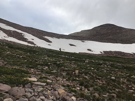
5.0Kings Peak(1 review) - High, remote and wonderful Points of Interest & Landmarks • Scenic Walking Areas
Though not as technical nor as remote as Montana’s Gannett and Wyoming’s Granite Peaks, King’s is deep enough in the High Uinta Wilderness to require some serious planning ahead or serious fitness to do it one day. I met a guy on Arizona’s Humphreys Peak who, like me, had failed to summit Kings in one day and vowed to return. Unless you’re a trail runner, pack your camp in and enjoy your visit. My son and I carried our camp 13 kilometres in, dropped our load, summited the same day we left our car but then had a night’s sleep before hiking out. It was glorious. I’ve listed this as Duchesne Utah because Trip Advisor didn’t accept it as Mountain View Wyoming though that is the most direct approach and the way we came in from, the Henry’s Fork Trailhead. Get a good map such as from Trails Illustrated. My phone labeled the photos on top as from Coalville Utah but it’s a long way from there, from Duchesne, too. My Gaia app said our total trip was 25.42 miles/40.9 km. We took advantage of the shortcut from Gunsight Pass. Snow fell on us on the summit in late August. It was a most memorable trip.See more..