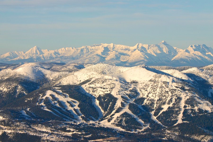
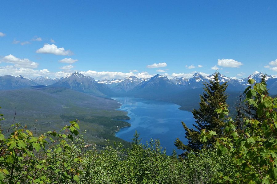
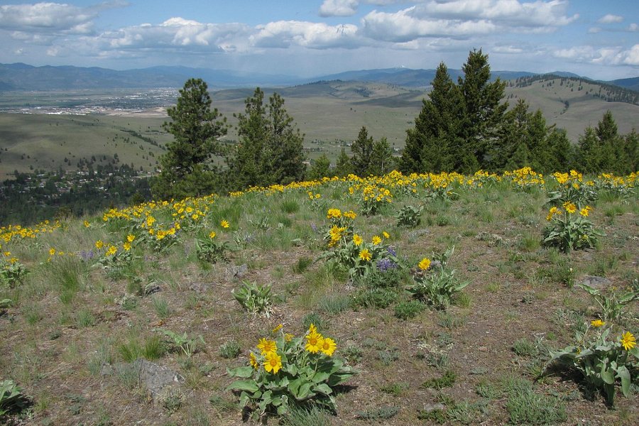
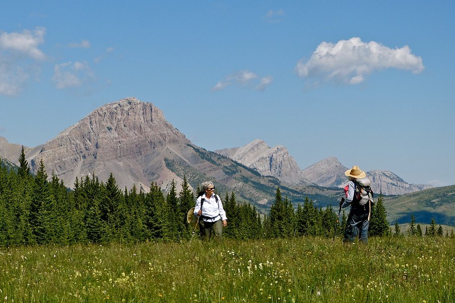
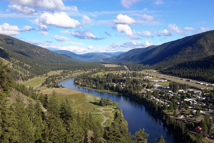
4.5Whitefish Mountain Resort(1.087 reviews) - Spectacular view while hiking down from the summit Saturday: 10:00 AM - 6:00 PM Biking Trails • Zipline & Aerial Adventure Parks • Hiking Trails • Ski & Snowboard Areas
My family of 4 took the chair lift to the top ($12 one way for each person) and we hiked down the Danny On trail. We did the "shorter" 3.8 mile trail and it was a lot of fun. It was a little steep at the top so I would recommend bringing a hiking stick. It levels off after about a mile and it's a really fun hike going downhill. We started around 1:30 p.m. and the mountain was pretty quiet. It almost felt like we had the mountain to ourselves at times. The view up top was just spectacular. You can the city of Whitefish and Whitefish Lake as you descend down the mountain. The hike wasn't too difficult and it took us about 3 hours to get to the bottom. We made lots of stops along the way to take pictures so that's why it took us a little longer to get down. After we were done, we found out that they do beginner's mountain bike lessons. We would love to try that the next time we're here.See more..
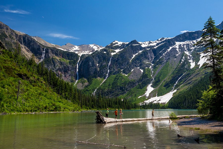
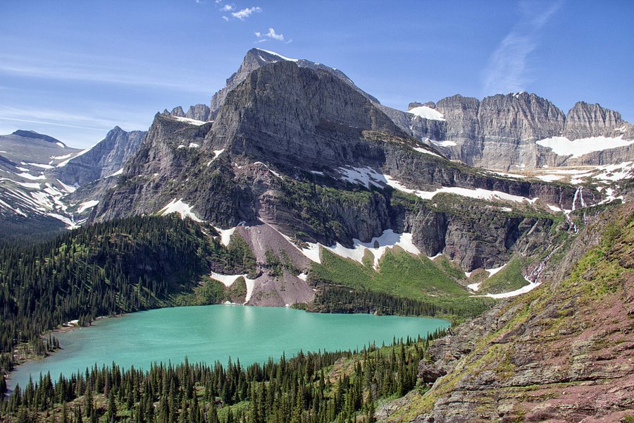
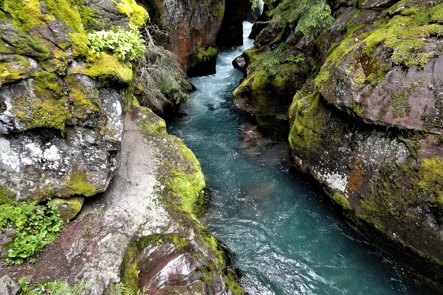
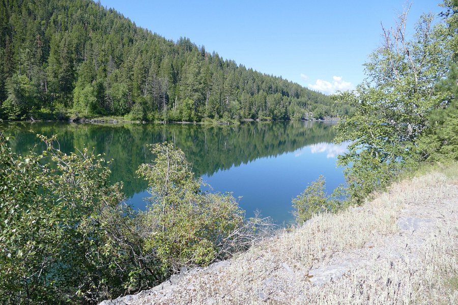
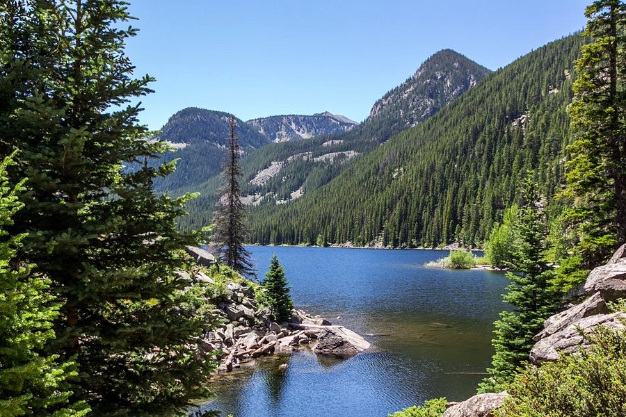
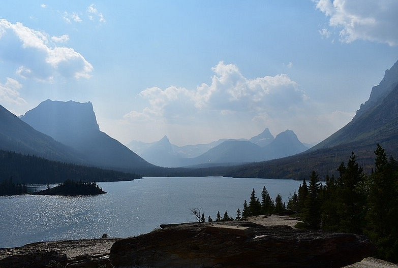
4.5Avalanche Lake(842 reviews) - Parking is a pain!!!!! Bodies of Water • Hiking Trails
A popular hiking area within Glacier National Park.See more..
The Ousel Falls Trail is a short 1.8 mile mostly paved hike on the outskirts of Big Sky Village in Montana. The hike is pretty and features a path that meanders along a stream ending at the Ousel Falls. Having seen some large waterfalls prior to this hike, the falls themselves were a little underwhelming. But the hike was still enjoyable and worth doing. It is easily accessible and can be done by people of virtually any ability level. Its location near Big Sky makes it very accessible and easy to get to. On the whole, I recommend hiking out to Ousel Falls for anyone who just enjoys going on peaceful walks or just being outside. There are some picnic benches available for those who want to enjoy a meal out in nature.See more..
4.5Trail of the Cedars(534 reviews) - We had to come back four times! Hiking Trails
We loved the .9 mile loop "Trail of the Cedars" adjacent to the Avalanche Campground in Glacier National Park. We found that coming up before 10AM was a great time to beat the crowd, get decent parking and enjoy the boardwalk and packed gravel trail before the hoard showed up closer to noon. We found the walk serene and recharging. The shadows, the trees (Cedar, Hemlock, Yew, and Black Cottonwood), Avalanche Creek, and the weeping cliffside provide every changing views. Looking beyond the trees affords views of snow covered horns and plunging cascades. Easy access to the confluence of Avalanche Creek and McDonald Creek just across Going-to-the-Sun Road. Did I mention that there are even real flush restrooms along this loop trail. Very nice and accessible for everyone.See more..
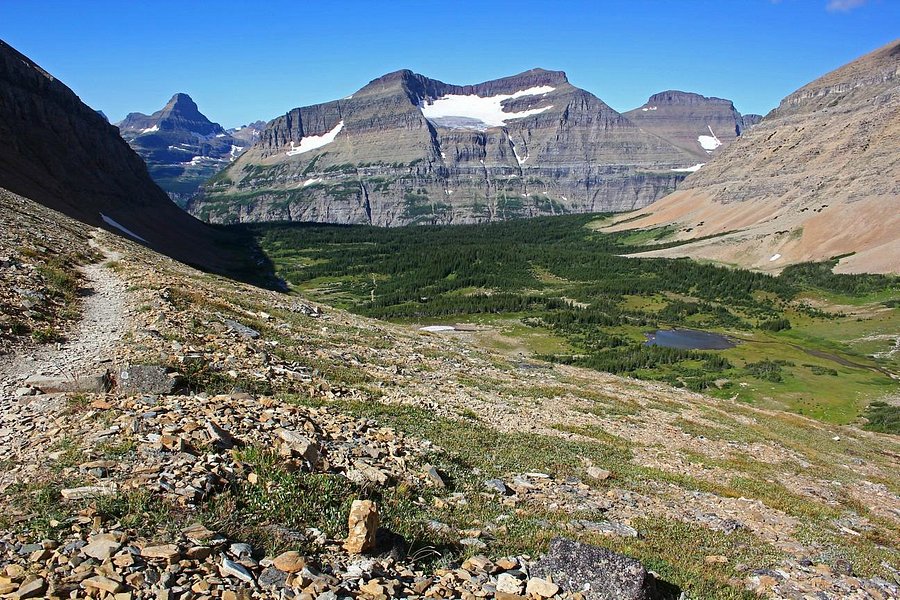
5.0Highline Trail(520 reviews) - Go early! Hiking Trails
A popular hiking trail with phenomenal views.See more..
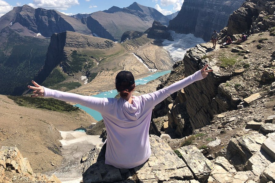
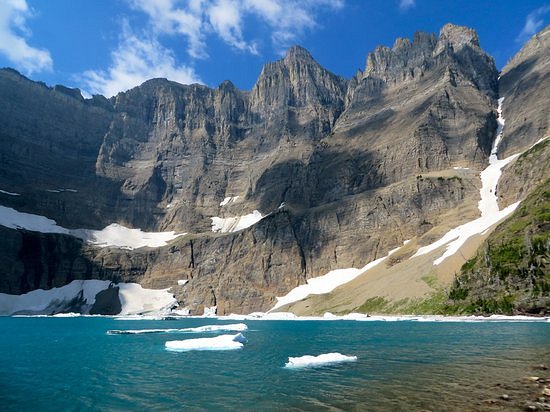
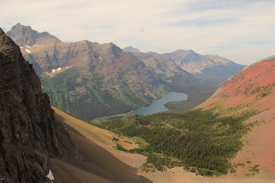
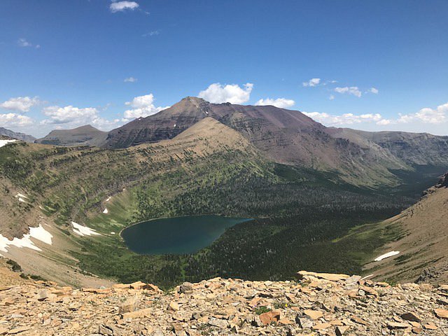
5.0Iceberg Lake Trail(478 reviews) - Great views but with a bit of a walk Hiking Trails
Hikers often wear bells and strike up loud conversations, so as not to startle the bears on this back country trail.See more..
5.0Swiftcurrent Falls(306 reviews) - Picture Perfect! Bodies of Water • Hiking Trails
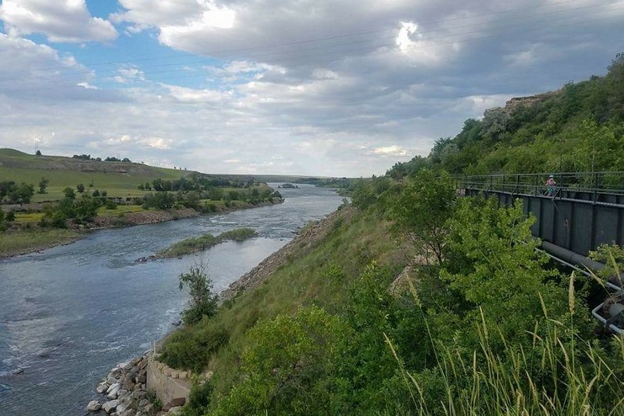
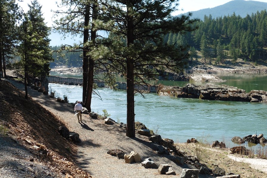
4.5River's Edge Trail(172 reviews) - some paved, some single track Hiking Trails
Yes, you CAN ride from the city of Great Falls on teh soutn side of the river all the way to the Great Falls themselves. You have to ride some pretty challenging single track up and down the canyon (and endure some pretty aggressive daytime mosquitos, too, on the single track). It makes for an all-day adventure of about 32 miles from the center of the city...but a great way to see the town and the river during COVIDSee more..
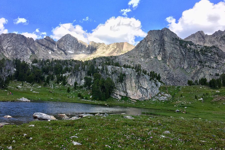
5.0Beehive Basin Trail(161 reviews) - Great hike for Mountain Lakes and wildflowers Hiking Trails
Nice hike for all ages and abilities. I am a forty year old out of shape Wisconsin visitor and easily completed the 7.5 mile round trip in 3.5 hours. Recommend an early start for ease of parking and uncrowded trails. A steady climb through meadow of wide flowers and groves of evergreens leads into a slightly steeper grade of sand and rocks. The pay-off is an alpine lake rimmed by granite cliffs that rise 1,000 feet from the flower carpeted basin floor. Venturing off the path on the far side of the lake and strolling through the flowers below the Spanish peaks is rewarded by stunning views of lone mountain.See more..
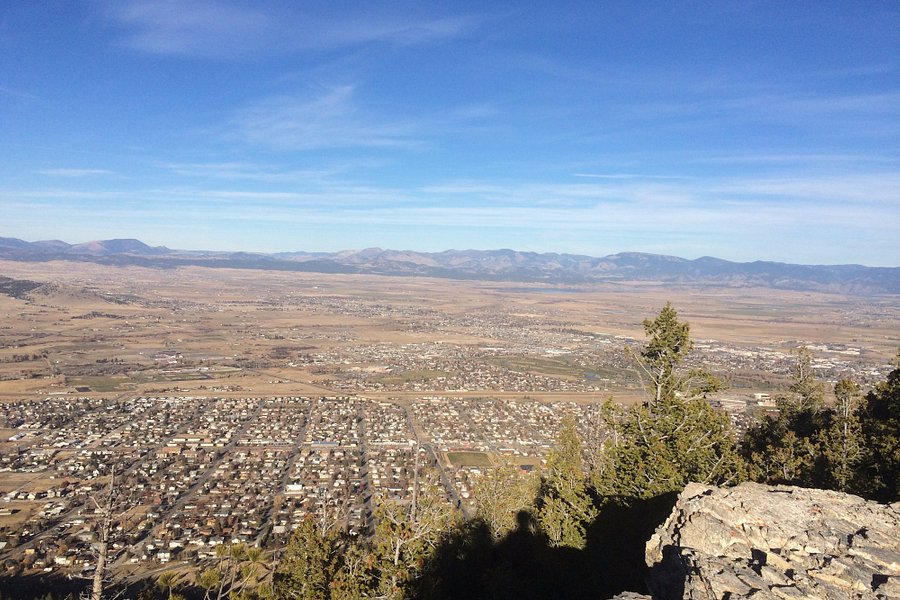
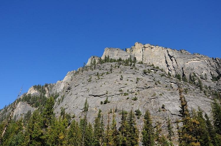
5.0Mount Helena(149 reviews) - Park with great views Mountains • Hiking Trails
Mountain good for hiking, biking, fishing and viewing wildlife.See more..
An all-season recreation area, this wilderness region is designated to promote the watershed, recreational, wildlife and educational values of the land.See more..
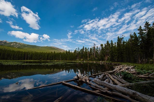
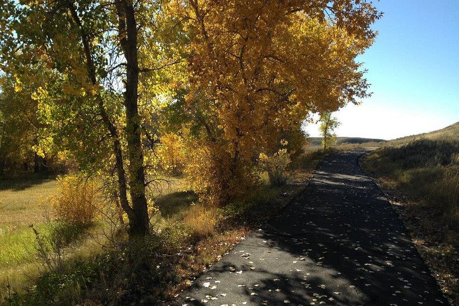
4.5Swan River Nature Trail(86 reviews) - Lovely walk along the river-caution for cliff edges for children Spent 1-2 hours Biking Trails • Hiking Trails • Jogging Paths & Tracks
Lovely easy walk on a previous old gravel road. It is flat and shady so comfortable on a hot day. There are great vistas along the way of Swan River as you are about 30-40 feet up on a hill along the river. We saw women with strollers, families, dogs on leashes, couples and three people on bikes. It is 2 miles in and out. There is a bathroom halfway and three picnic tables along the way. The only caution would be: keep a close watch on any little children running loose as it would be easy for a child to tumble over the edge down a rocky cliff on the river side. There are no guardrails. You can access the trail from above The Bigfork Inn in the City of Bigfork and Park there or you can access it along the bridge over Swan River where kayakers frequently “ take out” - parking available either end.See more..
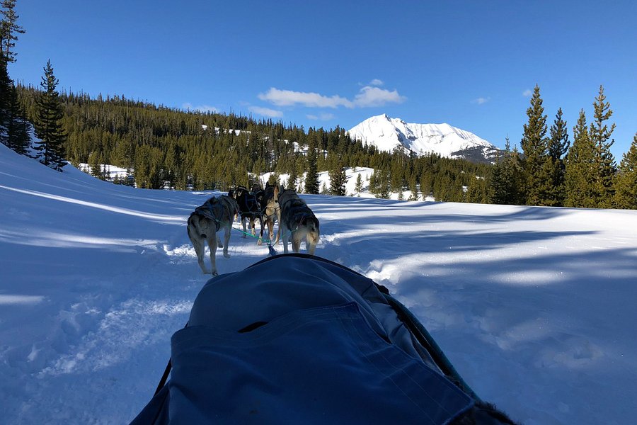
Highly recommended experience for folks wanting to create some unique, lifelong memories with friends and family. All the guides were very welcoming and the guide for our sled, Dalton, was a class act. He was well informed and pleasant to chat with, I learned a lot within the couple hours we spent together. The scenery is beautiful and the trail was well maintained. Plus, at the halfway point, you have a quick break with homemade cookies and hot chocolate! The dogs are world class sled dogs in retirement from running the Iditarod for the most part, and for the more adventurous types, you can absolutely pilot the sleds. Be sure to book well in advance (months), we lucked into a last minute reservation due to a cancellation.See more..
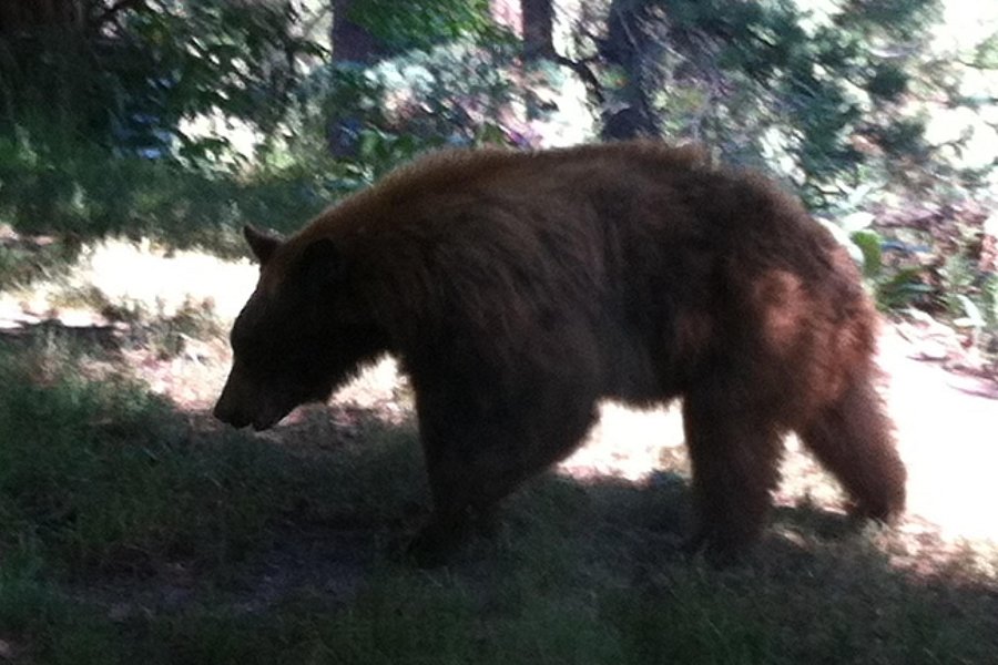
Enjoyed this informative hike that was lead by a docent that spoke of the information regarding brown and grizzly bears and hiking safely. Hiked some beautiful areas and learned so much on bear behavior. I cannot wait to hike all the trails here!See more..
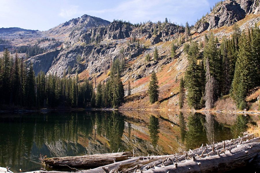
4.5Lava Lake Trail(51 reviews) - Stunning view! Spent More than 3 hours Hiking Trails
Gorgeous view at the top making the challenging hike well worth it. Kids are 11 and 9 - very active and no problems on the way up. We had lunch at the top and took a dip in the lake - very cold but seemed to put the 9 year-old in the best mood ever No wildlife sightings other than a snake on the way down. Would love to do this hike regularly if I lived here.See more..
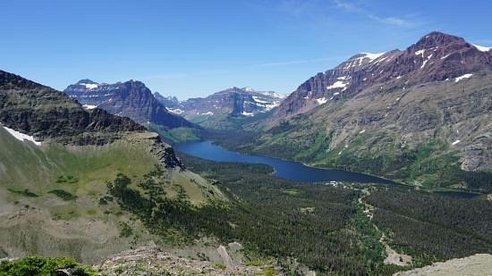
Loved this hike. We had no idea what we were getting into. We’re not hardcore hikers but we kept hearing how great this hike was. We started out not knowing how much of a climb it was. It was quite the incline but very much worth it! We made it up to Preston Park and Wow! Amazing views of Piegan Glacier as well as many others mountain peaks! You could definitely go further and I know there would be more amazing views! Do this hike! See more..
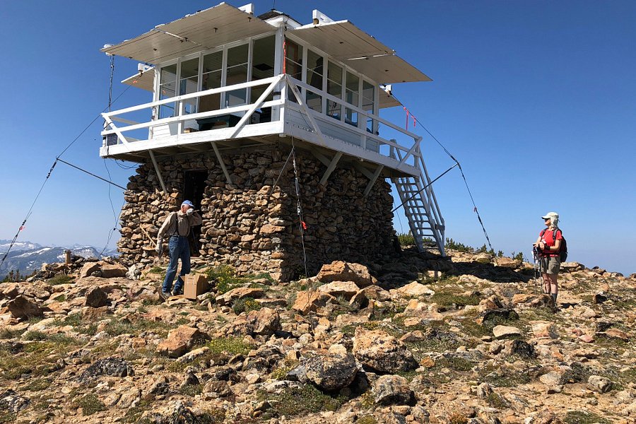
4.5Apgar Lookout Trail(42 reviews) - Great 360 View at the Top Spent More than 3 hours Hiking Trails
First, I’m a 63 year old man who had significant back surgery 9 months ago (L4-L5-S1 spinal fusion). I try and exercise daily but don’t over do it, walking and elliptical. So if I can make it to the top I think most people can. Second, this trail is about 3.8 miles one-way. So the entire trail is about 7.6 miles up and back. And it’s a 1,860 elevation change. The first mile is fairly level, the next 3 is mostly three long switchbacks up the mountain. Yes, the trail is a climb up that mountain in front of you (!) to the top where there’s a small building you can climb a staircase to, and walk around for a 360 view (and a large tall antenna next door). The views are awesome. Yesterday there was snow at the very top, but I was able to get through with tennis shoes. Try this, but just be aware what you’re about to do!See more..
4.5Scenic Point Trail(36 reviews) - Moon rates this as one of the best day hikes in the park Spent More than 3 hours Hiking Trails
Moon's 2017 "Glacier National Park" says this is one of the best day hikes in Glacier. A fairly difficult hike of 3.7 miles in each direction with a vertical rise of 2124'. Excellent lake views from up on top. It took me about 2 hours of steady climbing to reach the summit. Very windy on top with no cover. Be sure to bring a windbreaker. On the day that I did the hike, a number of hikers thought that they had reached the summit but were actually about .5 mile short. Keep on the track until you come to a tiny metal sign that says "scenic point" and an arrow pointing to a summit a couple of hundred yards from the sign.See more..
We have taken the trail to Grotto Falls many times. We even take out of town guests to the falls because it is so accessible for all fitness levels. Make sure to keep an eye out on the right as you are going up to see the mountain goats on the ridges; we generally see several every time we take the trail.See more..
4.5Cracker Lake Hike(35 reviews) - Best Hike in Glacier (and possibly my Life!) Hiking Trails
Yes, it is 12 miles long. Yes, you do have to endure horse droppings every 50 feet. Yet this is one of the prettiest hikes I have ever been on, both coming and leaving. But the real kicker is the lake; photos cannot adequately capture the color! I even rank this lake above Grinnell Glacier, Moraine Lake, Peyto Lake, Floe Lake, and Lake Louise (haven't gotten to Lake O'Hara yet). Not much effort is required to make it to this wonder - just longevity. Do it!See more..
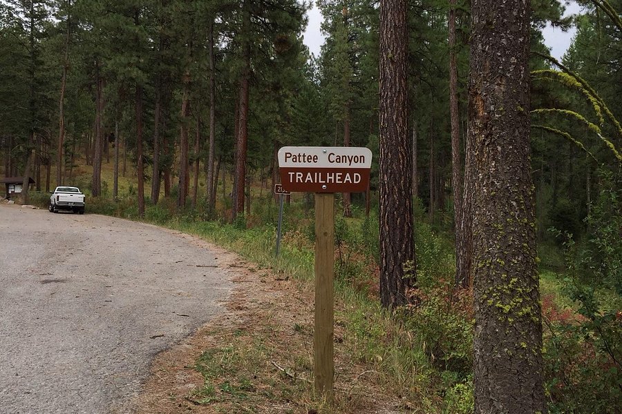
Pattee Canyon doesn't have the sweeping vistas of more remote mountains, bit these are very attractive and peaceful woods. You can lose yourself in nature without actually getting lost. There are anough trails here that a hiker can make multiple trips without repetition. A ftt cyclist can cover it in a day.See more..
5.0Pine Creek Trail(33 reviews) - Great , scenic trail Hiking Trails
The Pine Creek Trail is a moderate, scenic trail. Continue up to Pine Creek Lake which is a snow fed, gorgeous lake which feeds the waterfalls below, we took a brief swim in the water. It was exhilarating but VERY coldSee more..
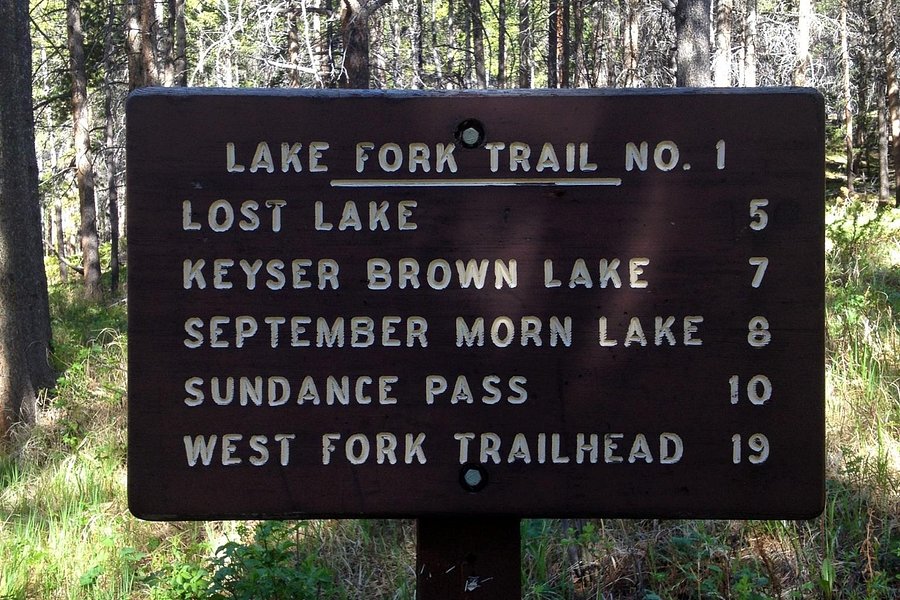
5.0Lake Fork Trail(33 reviews) - Loved this multi use trail Hiking Trails
Lake Fork Trail. Loved it. Loved to see the horses. To “Russian” who is poop fobic- you are on a trail that is designated multi use, including horses and whatever lives there. You knew this when you started- no whining now. If this bothers you , stay in the city or do a driving tour.See more..
I have been hiking the Kootenai Creek Trail since I was a young man. For over 50 years it has been one of my favorite places in western Montana. A little steep at first then a very relaxing hike for about 3 miles then it get quite steep up to the Kootenai Lakes. Bring your fly rod. The creek is full of 7-12 inch native cutthroat trout. I taught my sons to flyfishing on this wonderful creek.See more..
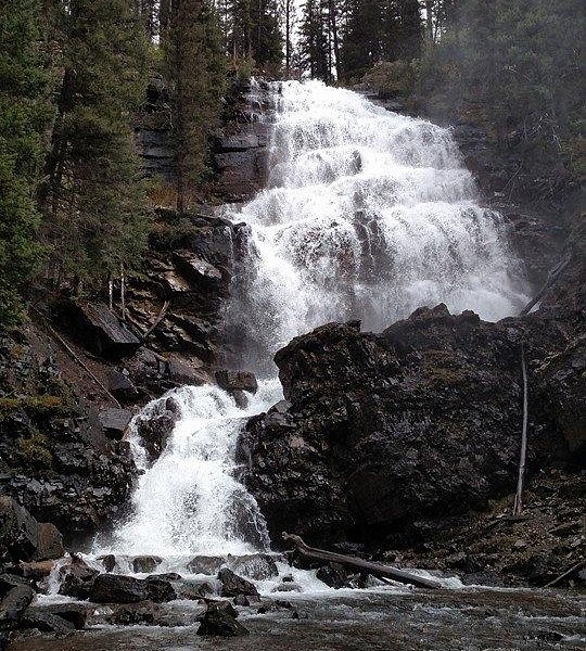
According to my Apple Watch it was a 2.7 mile hike (one way). The trail goes through a burn area and was hot during our hike today but it was in the 80’s. The trail had moderate traffic and it was fairly flat. There is a toilet at the trailhead and no cell service during the hike. The falls are beautiful and would definitely go again.See more..
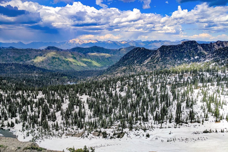
5.0Jewel Basin Hiking Area(21 reviews) - Clayton Lake Trail #420 Spent More than 3 hours Nature & Wildlife Areas • Hiking Trails
Awesome hike except the trail was overgrown and someone took a machete to it and left sharp blunt sicks into the trail which both my wife and I have huge scratches on our legs. I would recommend using soccer shin protectors. The fishing was great, 15-16 inch cuts that fight till the end. The hike was 1 h 45 m in and 1 h out. from the hungry horse reservoir west side road. Trail # 420 off Clayton Creek. Also recommend bear spray, we saw sign of Grizzly bears..See more..
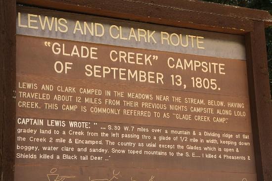
5.0Lolo Trail(17 reviews) - One of THE Most Gorgeous Drives Ever Hiking Trails
This popular hiking trail was made famous by Lewis and Clark's expedition.See more..
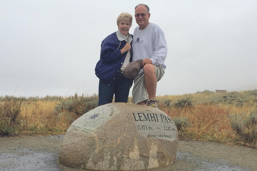
5.0Lemhi Pass(16 reviews) - Spectacular views and a peek at history Spent More than 3 hours Nature & Wildlife Areas • Hiking Trails
First of all, don’t be scared by the drive. We came up from Dillon and descended to Salmon with no problem. Of course, normal precautions while driving dirt and gravel roads should be taken. That said, this place is remote enough so that I cannot imagine it ever being crowded. This means that one gets to read and digest the excellent interpretative signs as well as drink in the wonder of the views. Knowing that Lewis and Clark stood in this very spot adds a little dash. See more..
4.5Middle Cottonwood Trailhead(16 reviews) - Short 3 mi RT hike with great views Spent 1-2 hours Biking Trails • Hiking Trails
A few words about directions..from the intersection of Saddle Mountain Road and Walker it is about 2 miles to the trailhead. The first mile is paved and the second is on a gravel road with some moderate size potholes. You will see some faded brown signs for Middle Cottonwood. There is a parking lot and some road side parking too. A very popular trail with locals. Follow the trail keeping to the left. It is a fairly wide trail at points gravelly then some larger rocks and some smooth areas. Follows the creek and then climbs to a saddle with great bowl views. Total about 1.5 miles from trailhead to saddle so RT3. There are 2 wooden "bridges" and one stream crossing on some large rocks. A little steep at times but easily reach saddle in an hour or less. Lots of flowers in bloom. Sneakers are fine.See more..
5.0St. Mary's Peak(14 reviews) - Worth the CLIMB!!! Saturday: 10:00 AM - 4:00 AM Hiking Trails
St. Mary's Peak is located roughly 3 miles West of Stevensville. It is a 30 minute drive to the parking lot off of St. Mary's Road off of Montana Highway 93. The road is well maintained during the Summer, however, Spring provides some rough ruts in the road so NO small cars please. Once to the parking lot, it is anywhere from an hour and a half to a two and a half hour climb, depending on your endurance. Once to the summit the views are incredible, in ALL directions! West in to Idaho, North to Missoula, South through the Bitterroot, and East in to the Sapphires! Take water and a sack lunch and enjoy the Fire lookout Ranger Station at the top. "Manned" during the Summer. Not an easy hike for beginners....See more..
5.0Ptarmigan Tunnel(14 reviews) - Fabulous hike Spent More than 3 hours Hiking Trails
Loved this hike, although we started from East Glacier, the views were amazing. Hikers of all levels were seen enjoying the trail. We saw families at the beginning of the hike, which was shaded and as we climbed up and out of the tree line the views were unbelievable. Ptarmigan Lake was popular for people to eat and rest before traversing up to the top where the tunnel has been carved into the mountain. Bring plenty of water!See more..
This beautiful trail is quiet even as you get to the waterfall a great spot for active people of all ages. This is bear country please be safe, bring a back pack, camera and energy for the hike. http://www.allredlodge.com/summer_recreation/hiking_backpacking.phpSee more..
Easy to do in a single day. Don't worry about taking the boat - it only cuts off a flat easy section. We cruised up to Dawson Pass and saw Big Horned Sheep on the way. At the top of Dawson Pass the views are incredible and every turn yields a different view that is equally as awesome as the one before. Beautiful lakes on the way, including a short extra jaunt to Old Man Lake. The trail is easy to follow, not very crowded and incredibly scenic.See more..
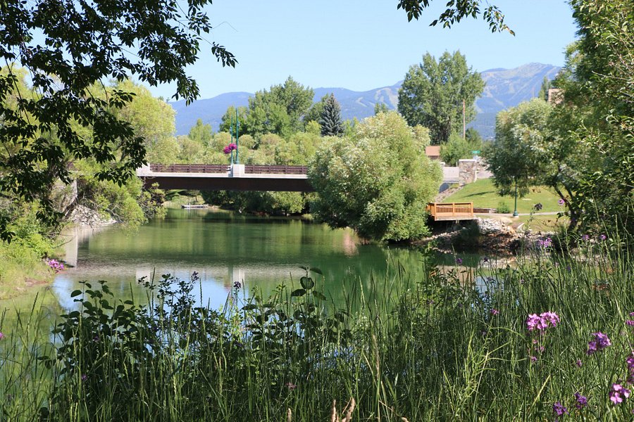
4.5Whitefish River Trail(12 reviews) - Very pretty and scenic river leading to Whitefish Lake. Spent 1-2 hours Biking Trails • Hiking Trails
My wife and I stayed at the Pine Lodge and we got a free kayak rental. The back of the hotel was right next to the river so we did a tandem kayak trip up the river to get to Whitefish Lake. It was a fairly easy trip and it took us about 40-min to reach the lake. The trip was very quiet and scenic and we even saw a deer on the way! You pass by a few bridges and it's a fun trip.See more..
5.0Mount Jumbo North Peak Trail(12 reviews) - Wildflowers and Vistas Spent 1-2 hours Mountains • Hiking Trails • Forests
This is a great time to visit the Missoula City Open Space starting at the dirt parking lot and trail access kiosk near the end of Lincoln Hills Drive. The lupine, bitterroot, penstemon, cushion buckwheat, Indian paintbrush, and many other flowers are blooming now, and this is a great place to walk for views toward Missoula, East Missoula, and the Rattlesnake Peaks. The elevation at the parking lot is about 3700', and two of the shorter trails from this lot go to Mt. Jumbo (4768') and the North Peak (4440'--more like a long ridge with a high point). While the trail up Jumbo is steep in places, this route has much less elevation to gain than the trail at the end of Cherry Street, and the trail up the North Peak is not steep at all. To find these trails, walk to the saddle and watch for trails that head either north, for the North Peak, or south for Jumbo.See more..
4.5Clarks Fork Trail(11 reviews) - very pretty and accessible Hiking Trails
Easy to find, ample parking, pretty location, trail maintained OK, not too strenuous - nice place for a picnic lunch.See more..
5.0Silver Run Trails(11 reviews) - Beautiful views along the river Hiking Trails
Great area to hike and some people were also mountain biking it. Plenty of room to park. The trail is fairly flat. The return trail goes along the river. Beautiful views. I did see one person fishing in the river as well. They did spot grizzly bears in the area in July and August.See more..
Thompson Falls Community Trails is made up of the Powerhouse Loop Trail (2.3 miles) and the State Park Trail (1.4) which connects downtown Thompson Falls to the Thompson Falls State Park. This trail follows the beautiful Clark Fork River below the Thompson Falls Dam. Wildlife viewing, sandy beaches and geologic structures are best kept secrets along this non-motorized route!See more..
5.0Dropstone Outfitting(9 reviews) - Picture Perfect! Saturday: Spent More than 3 hours Nature & Wildlife Areas • Hiking Trails
Dropstone Outfitting specializes in stock supported hiking trips throughout Montana's Bob Marshall Wilderness. We cater to hikers who only want to carry a light daypack while participating in multi-day wilderness adventures. Enjoy the trail while our pack string carries the gear for you.See more..
Emerald lake trail is beautiful, falls as well. It's all uphill so bring water and something to eat and get used to the elevation if you can. I think we've hiked it 3 times in the last 10-15 years. It's a busy trail but we'll worth it.See more..
4.5Roadrunner Trail(8 reviews) - Fun and Challenging trail!! Spent 1-2 hours Hiking Trails
This a fun and challenging trail. You can make it a challenge or you can just have a relaxing walk. Always a beautiful walk in Spring , Summer and Winter. I recommend this trail to everyone.See more..
This is an easy .9 mile loop that can be accessed from the parking lot at Sun Point, on the western end of Lake Saint Mary. The elevation change is not great and the trail; while made of packed dirt, is in good condition. Smoke/haze from western fires made for poor picture quality, but it was still very beautiful.See more..
Nice views after a short hike that does include some rocky, uneven areas. Pretty scenery along the river, with a small beach access at the beginning.See more..
We started up this trail not realizing how far it was to the lake, and there is not good signage telling you about it. The creek or stream that you start at is very nice with a cut little bridge over it and then it is a constant uphill … we walked for about 30 minutes and there wasn’t a lot of great scenery and so we went back down. It was probably for the best as not long after we got to the truck and on the road a massive storm passed through that dropped large trees in the road. We had so many other things to do we never went back. See more..
4.0Vista Trail(4 reviews) - Hike with my honey. Spent 1-2 hours Hiking Trails
This is a great little mile plus hike rising about 800 feet above the town of Superior, MT. Six benches that can be used for a brief rest or you can sit for as long as you want while enjoying the beautiful scenery.See more..
4.5Golden Trout Lakes Trail(4 reviews) - Beautiful Trail; Even More Beautiful Lakes Spent 2-3 hours Hiking Trails
We did this trail with two other couples in July...it is a beautiful trail that leads to an even more beautiful lake, Golden Trout Lakes. We ran into another set of hikers on the way up and they had on very large bells (they had run into a couple of griz the day before while hiking). Yikes! The lakes were just gorgeous and we even fished for a bit. Lovely hike!!See more..