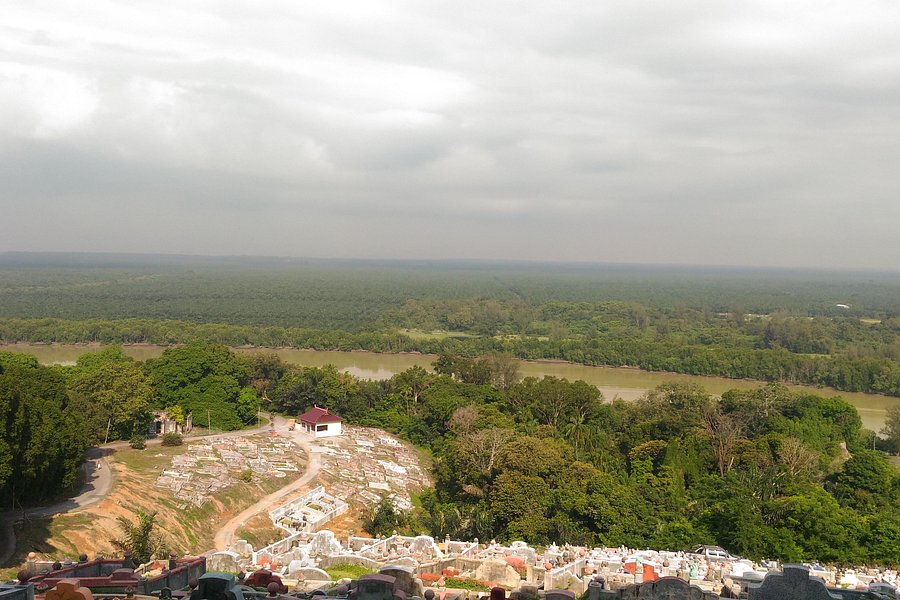
Awesome view from the top of the hill around the light house. It is possible to drive all the way to the top or take a hike from the foot of the hill. Great place to take in the sights and let your worries float away.See more..
4.0Bukit Kembara(2 reviews) - What a view Spent 2-3 hours Hiking Trails
We visited the place during night. The road on the hill has some good roadside local food stalls. Cheap food and great taste. But on top of all.. what a view.. the whole KL skyline from one place... cooler the city and calm.. Highly recommendSee more..
3.5Gunung Hitam(2 reviews) - Gunung Hitam Hiking trail in Hulu Langat District Spent More than 3 hours Hiking Trails
You can hike here and head to Sg Gabai waterfall for part 2 or you can also jump into a mini waterfall cascades which can be found along the path of this trail. Total journey about 12-13km which took about 8am to 2pm for moderate paced hikers with 50% of trail uphill. This is not for beginners though. Leeches come and go. During out turn only meet with 1 leeches at other times i heard there was plentiful. Not much of view at summit but a great outing day.See more..
5.0Lata Gapi Waterfall Cascade(1 review) - Waterfall cascade Lata Gapi in Antara Gapi Thursday: 12:00 AM - 11:59 PM Hiking Trails
Parking – Open space by roadside opposite housing area The coordinates 3.422554, 101.646619 (Jalan Antara Gapi - Ulu Yam) Distance- 6.34 km ( Both Ways ) Elevation 145m Difficulty- Easy Go past housing areas in a wide sandy route and follow the hazard ribbon markers until you reach a plastic chair this is the turning you cannot miss to head to the waterfall area. Shoe will get wet as they is quite a few streams to pass. Tall waterfall cascade with shallow pool. If you are adventurous can go higher but becareful when you attempt to step on the stones on your way up. Two big pool at top for deeper skinny dip. Have area for maybe a few camps near waterfall area if you are into it.See more..
5.0Ah Pek Hill(1 review) - Hiking Bukit Ah Pek Spent More than 3 hours Hiking Trails
This is a very popular hill for hiking in the vicinity of Kuala Lumpur. It is officially known as Bukit Putih. There are a few starting points to hike up this hill. The most popular one is from Taman Awana Cheras. There are also people hiking up from Taman Wangsa Cheras and Taman Hartamas Cheras. The Awana Cheras trail head starts at the end of Jalan Awana 23. This was the trail that we took when we hiked up this hill last week. We turned left at the start of the trail head. From there we hiked all the way to Station 6 which is the peak of Bukit Ah Pek. It took us about 40 minutes. The trail was not steep and suitable for beginners. Along the way, we passed by a small water station provided by the local hikers as well as an exposed area with high voltage power transmission towers. Station 6 at the peak of this hill is beautifully decorated with red lanterns and other decorations giving it a Chinese New Year look and atmosphere. There is a stall selling drinks and snacks. Do not miss out the tree house in one corner. From Station 6, one could proceed to a neighbouring hill, Bukit Saga or hike down to Station 5, about 15 minutes away, to complete a loop. From Station 5, we hiked to the Bukit Saga waterfall, it took us about an hour to hike to the waterfall and back to Station 5. There is also a stall selling drinks at this station. From Station 5, we hiked down to Station 3A ( Station 4) in about 30 minutes. After that, we continued our hike down to Station 3 in 15 minutes. Then we chose a shorter trail out where we by-passed Station 2, going straight on to Station 1 and back to the trail head at Awana Cheras. Please refer to the photo attached for a general idea of the trail and stations mentioned above. The trails are well-marked and well-trodden and stations are very well-maintained and clean. Congratulations and a big thank you to the local hikers there. Happy Hiking!See more..
Our top favorite recovery after trail/tracks in Kemensah. Lubuk Tedung is one of the motivating and inspiring running, and hiking spots that applies particular needs to each trail runner, ultramarathons, and other tough endurance challenges. With the best sound of river cruising near the spot. Lubuk Tedung is my top favorite place to hang out with my buddies. Recommended to new beginners in trail running, and hiking. See more..
4.0Bukit Chenuang Trail(1 review) - Bukit chenuang hike from Ampang Trailhead Hiking Trails
This is another entry point to Bukit Chenuang Hike. From Kampung Kemensah to Batu Kumbang to Bukit Chenuang. Est 20km. 7am to 4pm. If you still have got fuel left can head to the waterfall for additional fun. There is 4 waterfalls here for your picking at nearby trailhead. Hike level- Moderate to hard. Not for new bie's and unfit body.See more..
3.0Bukit Lagong(1 review) - hiking trail in Batu caves area Hiking Trails
Distance : 14km if you do the full loop Trail: Very raw and unmarked Leeches is prominent in this location. Duration: 6-8 hours. Get to see two hills : Bukit Nolang and Bukit Lagong. Both dont have view. Hike Level : Not for newbie and unfit hikers. Quite a challenging hike as its not a common trail so need to pay attention and spend more time finding trail.See more..
The starting point is located between Fazer's Hill gap and Sg Semangkuk waterfall. I was there with a group of friends trying out this unfamiliar trail. Bukit Chorocho or local people pronounced it as Koroko is not a well-known hiking trail in KKB area. Parking space was limited but you can park your car at nearby Sg Samangkuk waterfall and car-pool to the starting point. The hike would take about less than 1km until you reached the river. You can either get your shoes wet or walk across barefooted. The water was clean and clear and very refreshing. After crossing the river, the hike up was quite steep, and you need to preserve until you reach the peak. There was no view, but the peak has ample space for you and your friends to relax and celebrate the achievement reaching Bukit Chorocho. Always be extra carefull hiking down as you will need to balance your feet with slippery and steep trail. One more thing to be reminded there were a lot of leeches around. Just be ready with your leech repellent. You can start your hike around 7 to 8 am and can complete before 12 pm. after the hike you can change and wash at Sd Semangkuk waterfall to refresh before heading for KKB town for lunch.See more..
3.0Bukit Unyang(1 review) - Bukit Unyang Hike Hiking Trails
If you are in Kanching forest reserve and up for a hike challenge apart from playing with waterfalls, Bukit unyang is the go to summit. Sharing same route from Kanching forest waterfall no 7 , trail you can continue to extend further up after the waterfalls to go into the forest for the hike. distance about 2.5-3km. Hike duration - 3 hours. hike level- Not for newbies and kids as the elevation is quite steep. Leeches may be present.See more..
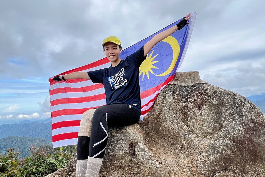
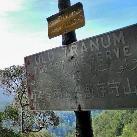
5.0Gunung Gap(1 review) - Scenic Route Gunung Gap & Ulu Semangkok via Bukit Fraser Mountains • Hiking Trails
Max elevation: 1360m elevation, 7km Permit: RM10 Hour: 4-5 hours . Special thanks to the organiser, we get to enjoy such a scenic route. I am flabbergasted by the cleanliness of the trail, it’s well maintained that you get to enjoy seeing the flora and fauna. Best of all, a sneak peak to the mossy forest. . Due to the rain, some part of the route claimed to be medium muddy. Not enough to consume your shoes, but enough to make you fall if you are not careful. . Don’t be discouraged by the elevation at the starting point. We must taste the bitter before the sweet. At first I thought it’s a wall, who knows it turns out to be the starting point. it’s a good hamstring day, trust me, the view is definitely rewarding. . We are lucky that after we landing safely back to the starting point, the rain starts to shower again. At least not during our hike. Overall, it’s a good hike, no leech and bee bites. Kudos to our team!See more..