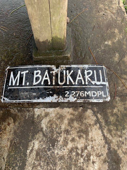
Mount Batukaru, Bali, Indonesia
4.5 (8 reviews) Spent Ranking #26 in Tabanan Mountains
Mt. Batukaru - an Alternative to Mt. Batur
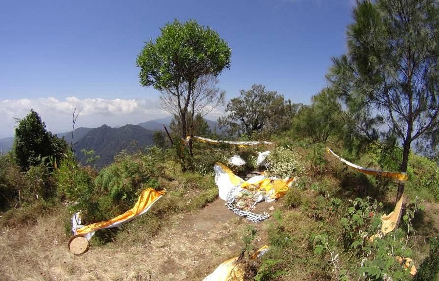
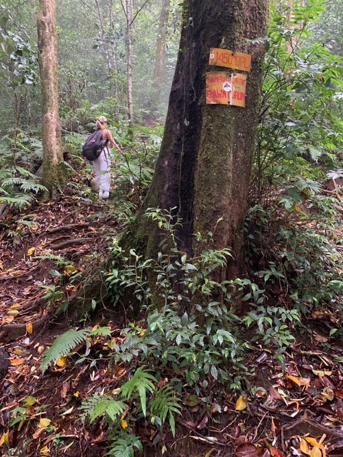
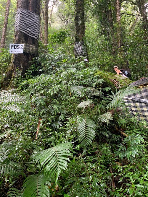
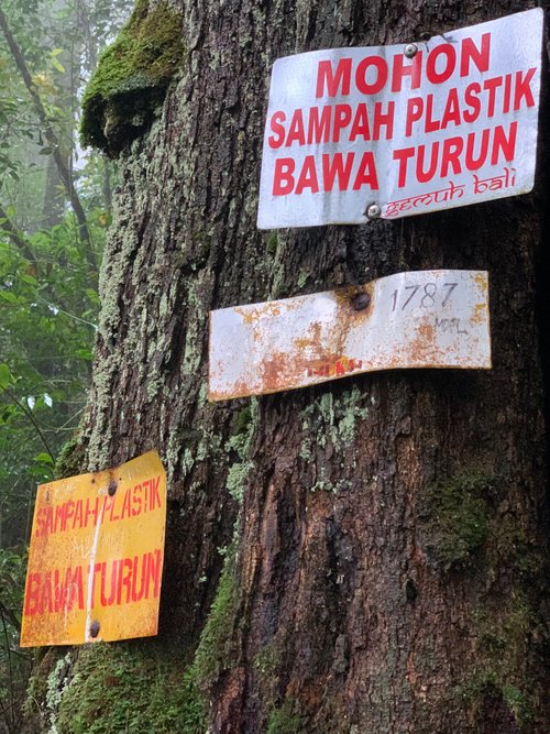
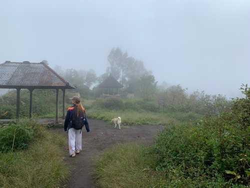
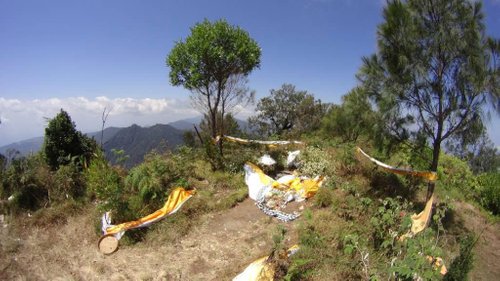
Hiked Mt. Batukaru via the Jatiluwih Trail from the Pura Luhur Bhujangga Waisnawa Temple. Mt. Batukaru is higher, wilder, and far less commercialized than Mt. Batur. However, the trail is steep, slippery, narrow, rutted out, and infested with leeches. It is also criss-crossed with spider webs (the spiders are small and apparently harmless). There were no people on the trail when I hiked it - no tourists, no locals hawking "guiding services," and - best of all - no "mafia." The trail is well marked with yellow ribbons (sadly there's also a lot of trash). It took me 2 hours to reach the top and 1 hour, 45 minutes to descend back to the trailhead. Although it was hot, I recommend wearing long pants and gaiters to prevent leech bites (I got bit four times on and around the ankles). Bring a rain jacket, as well. Although it was cloudy and I had no views, this was a very satisfying hike through a spectacular rain forest.

Address
, Tabanan, Indonesia.
Current local date and time now
Friday, May 10, 2024, 21:40
User Ratings
4.5 based on (8 reviews)
Reviews
-
4Erik_Mariachi 5:00 PM Oct 11, 2014
Landscapes, rainforest, alternative track
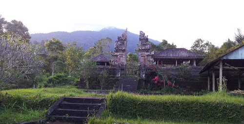
Although Mt Batukaru is the 2nd highest mountain in Bali, it doesn't allow you to see much from the top. As an extinct volcano, it looks more like a rainforest - which is quite true, as I met a frog as high as 1700 m. Base. Take your time to stop your bike and shoot photos of these paddyfields between those serpentine curves on base of Batukaru. They are better than most other mountains can give you around Bali. Fee. There is an alternative route, where you will find a booth collecting money for tickets to the temple - but if you are with a local and a racksack, it is quite easy to convince that you are going to have a 1-day trekking. No need to pay anything. You may need GPS at the beginning, but no paid guide. Track. It was dry at the end of September, but do expect a very slippy track if it's gonna rain. The last third of this alternative road is bushy, often thorny, so wear long pants and sleeves to avoid scratches. But it is rewarded with a nice rest at the top, between several pura's/temples. Time. It is said 5 hours up and 3 down, but it inludes already several 20 minute stops.
-
4Jason S 5:00 PM Nov 12, 2018
Mt. Batukaru - an Alternative to Mt. Batur
Hiked Mt. Batukaru via the Jatiluwih Trail from the Pura Luhur Bhujangga Waisnawa Temple. Mt. Batukaru is higher, wilder, and far less commercialized than Mt. Batur. However, the trail is steep, slippery, narrow, rutted out, and infested with leeches. It is also criss-crossed with spider webs (the spiders are small and apparently harmless). There were no people on the trail when I hiked it - no tourists, no locals hawking "guiding services," and - best of all - no "mafia." The trail is well marked with yellow ribbons (sadly there's also a lot of trash). It took me 2 hours to reach the top and 1 hour, 45 minutes to descend back to the trailhead. Although it was hot, I recommend wearing long pants and gaiters to prevent leech bites (I got bit four times on and around the ankles). Bring a rain jacket, as well. Although it was cloudy and I had no views, this was a very satisfying hike through a spectacular rain forest.