Doi Khun Tan National Park, Lampang Province, Thailand
4.5 (14 reviews) Spent Ranking #2 in Mae Tha District National Parks • Parks
Great hike
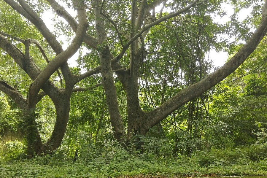
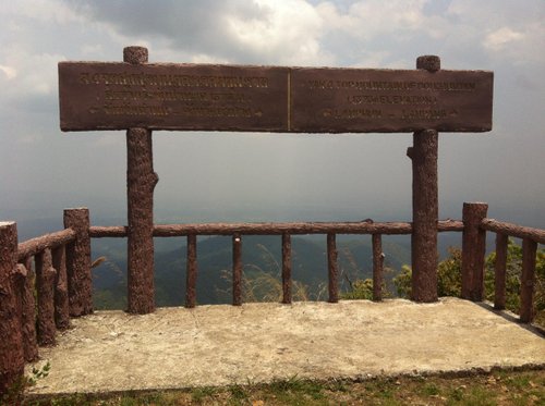
I did a day trip from Chiang Mai today to the summit of Khun Tan. It Is a great escape from the city. I caught the 8:50 train from Chiang Mai, and got up to the visitor center by about 10. The total hike me about five hours, and that was including the looploop to the waterfall. The hike up it was fantastic, I did it on my own and had no concerns and the view at the top is spectacular. The loop to the waterfall wasn’t worth it in my opinion, at this time of year the water wasn’t running very fast and it’s a lot of extra uphill and downhill. Overall it was a fantastic day from the city, I got the 18:20 train back to Chiang Mai and was back to my hostel by 8 PM
Address
Mu 8 Tambon Tha Pladuk, Amphoe Mae Tha, 51140 Thailand
Current local date and time now
Wednesday, May 15, 2024, 19:37
User Ratings
4.5 based on (14 reviews)
Reviews
-
4funkit 5:00 PM May 24, 2015
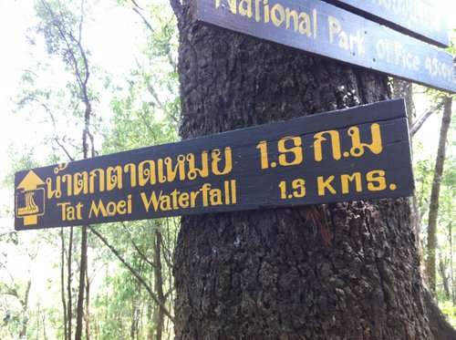
The trail running via Tat Muey waterfalls totally blocked
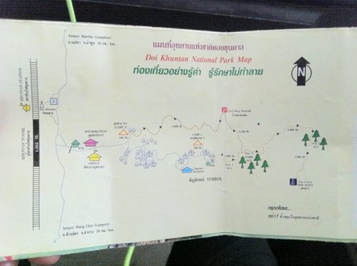
The experience of hiking in the quiet Doi Khun Tan National Park for a workout was great but the unexpected result of almost getting lost here prompts me to remind visitors NOT to go to or leave the peak via the route with waterfalls. Tired of meeting the crowds during the tours of white water rafting, elephant riding etc, we hired a taxi (1,800 baht incl gasoline) for a day trip to the park on 6 May. We were given a map which showed two routes going up the 1,300m+ peak. Strictly speaking it was not a map, just a rough plan of the routes which were not drawn in scale. But we didn't question the accuracy as we didn't think anyone can get it wrong with only two very clear routes here. One passes through clusters of bungalows (say route A) and the other through waterfalls (route B), each about 9km in length which meant the hike should be 18km long. We decided to take route A up because we planned to dip the falling water after hiking on a rather hot day. I guess there were only two of us visiting the park that day and we were so happy we occupied the 'entire' park by paying a few hundred bahts' entrance fee. Everything went well and we took 3 hrs to get to the top. We left the peak with about 300-400ml of water. We were excited rushing downhill. However, after we had reached Tat Muey (or Tat Meoi) Waterfall, we couldn't find any defined or ill-defined trails to continue our way back. We hiked incl bushwhacking several times a week in HK so we would easily identify there was any trace a trail, even if a bit bushy, existed. But no. Fallen trees, bamboos, rush have filled the area around the waterfall. Our search of an exit for almost 30 min ended in vain. I tried to make a roaming call to my taxi driver for rescue yet there was no phone reception. We yelled and heard only our echo as there were really only two of us in the mountains. We did consider moving to the west 'at all odds' (national park entrance 'should be' in the west according to the leaflet in hand) or climbing down along the rocky/bouldary river bank to look for our way. We dropped that idea eventually because it's already 4ish and sun was setting soon; it's very hard to move any 30m further but the national park entrance was 3-4km away; we would have no energy and run out of water if we failed to find our way and decided to turn back to the waterfalls; worse was if we got lost somewhere far away from the waterfalls, it would be difficult for the rescuers, if any, to locate us. Finally we made the hard decision - stop searching for route B. With about 200ml water and being very very tired and thirsty, we walked a few hundred metres up back to join route A again. We were lucky to get resupply of water from an old man in the midway. He may be the only one living in the park's mountains (between Viewpoint 1 and Viewpoint 2). By around 6ish, we came returned to the park entrance and did a total distance of 21 km. We learnt that the park had sent 4 people to look for us on the trail. Losing contact with us worried them as visitors normally came back by 4pm. As the trail around Tat Muey Waterfall 'disappeared', it was dangerous for anyone to go there without preparation. We asked the staff of the visitor centre to check and scout the route and make sure it exists and seeable before the park management let people take the route via the waterfall. The taxi hire was assumed to last from 8am to 5pm. We didn't get back to town until nearly 8pm. We paid an extra 400 baht as compensation for car waiting. Thank god we made it to catch our flight at 6am the following day. Having said that, I didn't regret the escape from the overcrowded, popular tourist spots in other parts of Chiang Mai to the nature. Sorry for not being available to share our experience earlier as life is hectic in HK.
-
5guillaumepremier 5:00 PM Dec 20, 2019
Perfect day hike
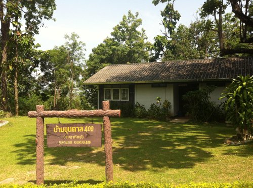
The accessibility of the park by train is a big plus. No need for expensive taxi service or time-consuming bus changes. The hike was not touristy, but well traced and very enjoyable. The summit at the top offers a nice view and was very rewarding. We took the 10 a.m. train from Lampang and arrived in the cute little station of Khun Tan at 11 a.m. You can leave your backpack at the station. From the station to the park's entrance, count 20 minutes by foot. At the time of visit (dec.2019), the entrance to the park was 100 baht. The visitor center at the entrance provides a free map of the park. There's also a small restaurant and a shop selling water bottles, among other things. There was only one trail, going to the summit. The other trail (towards the waterfall) seems to be closed since quite a while. The first part of the trail (from the visitor center to camp 1 ("yom 1") lasts about 2km and is partly on the road. There are shortcuts cutting the road's hairpins. At camp 1, names and phone numbers (in case of emergency) are written down in a register. Looking at the register, I could see that only 14 persons were taking the hike the same day as myself. Although it was high season, Doi Khun Tan was not touristy at all. It took approx. 2h00 to cover the 5km from camp 1 to the summit. Adding the time needed to go from the train station to camp 1 (through the visitor center), I believe 2h30 at a "normal" pace is a realistic estimation to reach the summit.To go back down, two hours will suffice. The trail is very well marked and easy to follow. No crossings, no confusion possible : it's all very straigt-forward. In december, the trail could be done without specific hiking shoes. In the wet season, this might be different. A train leaves Khun Tan at 18h23 to reach Chiang Mai at 19h30. Check Thai Royal Rail to check timetable changes. All in all, a highly recommendable day hike.