Bear Mountain, Connecticut, United States
4.5 (11 reviews) Spent Ranking #1 in Salisbury Mountains
Bucket list item check
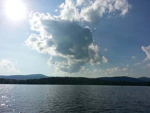
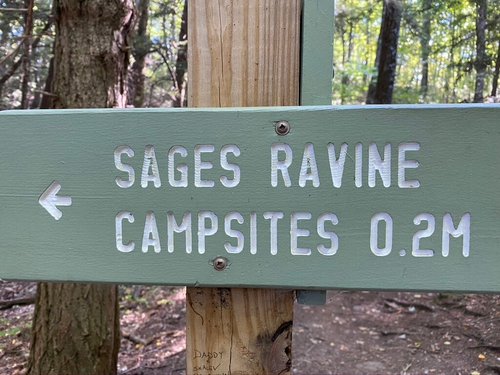
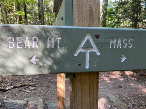
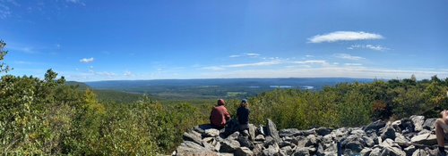
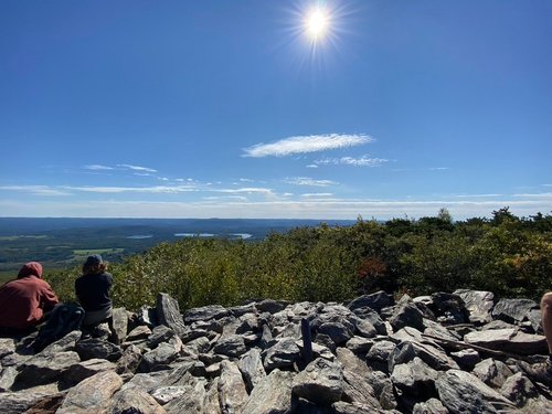
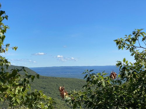
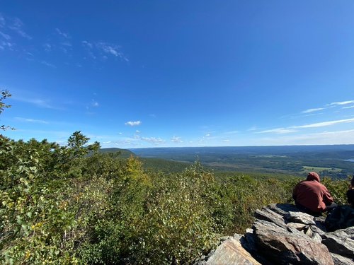
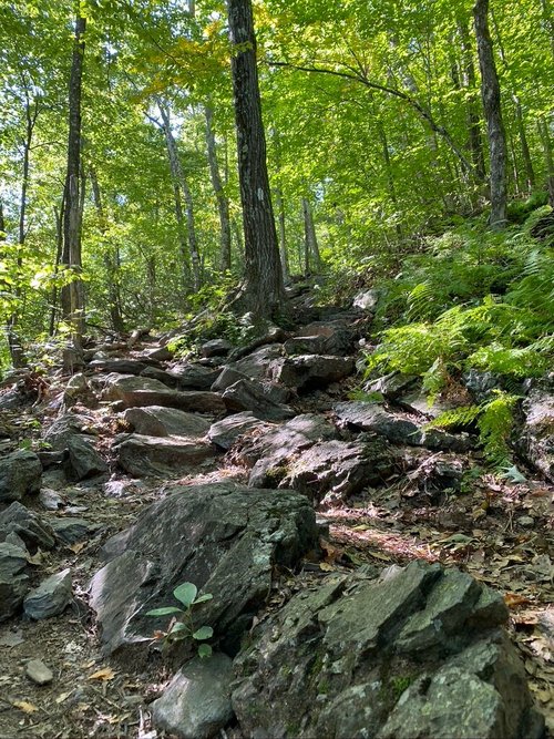
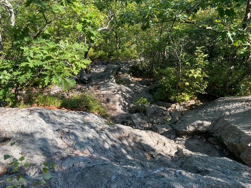
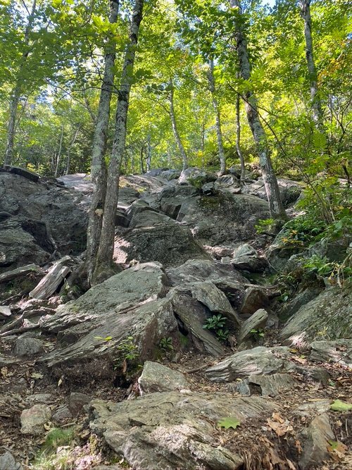
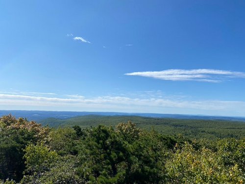
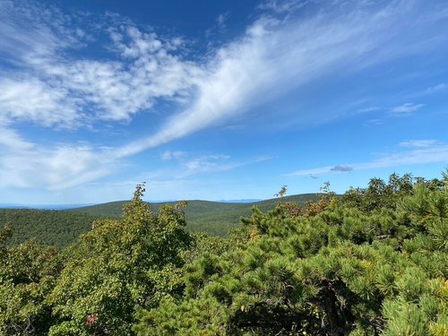
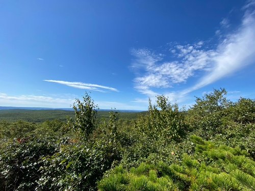
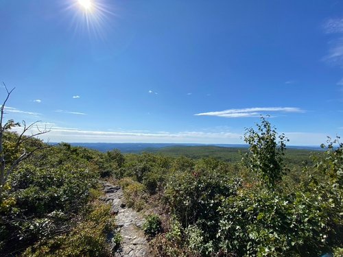
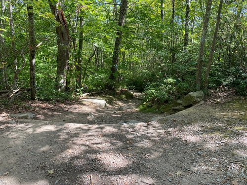
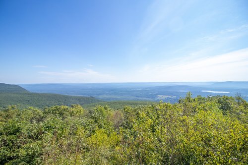
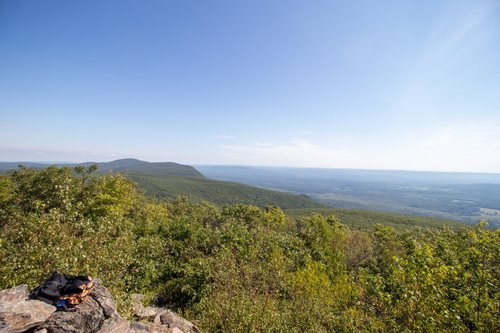
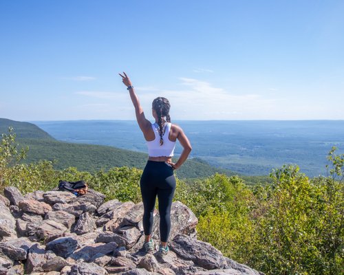
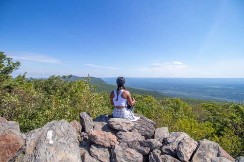
Very well-marked trails. I went counter-clockwise so had to go up the steeps near the top. Which was better than going down them. The view from atop the rock pile at the top was great, had it not been there the views would be underwhelming. I left early to beat the crowds and seemed to be the right call as to when I got back to the lot cars were lined down the street. Rocky, rooty, and steep in some sections. It was also VERY dry almost no running water.
Address
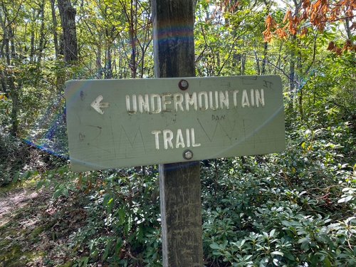
Rt 44 Undermountain Trail Head, Salisbury, CT 06068
Website
http://www.amc.org
Current local date and time now
Wednesday, May 15, 2024, 15:43
User Ratings
4.5 based on (11 reviews)
Excellent
64%
Good
27%
Satisfactory
9%
Poor
0%
Terrible
0%
Reviews
-
4Andres C 5:00 PM Aug 22, 2020
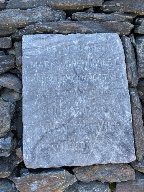
Highest Peak in Connecticut
I’ve had Bear Mountain on my “hiking to-do list” for quite some time. Knowing it was the highest peak IN Connecticut made it more exciting for me. There’s a mountain in Connecticut with a higher peak, but although you start the hike in Connecticut, the peak is actually in Massachusetts. So, Bear Mountain it was! We got started early on a Saturday morning (August). We were there at about 8:30-8:45a. There’s a small parking lot with a blue oval sign. I got lucky enough to get a spot, but at that time there were limited spaces already. The hike itself was great. The trails are well marked and easy to follow. We took the blue blazed trail to paradise trail and then jumped on the white blazed trail (left) at the AT crossing. The last 15 mins of the hike were challenging. It’s all mostly rocks and you’ll have to do some scaling on a few of them. My friend and I consider ourselves very fit and both agreed the last bit was challenging. My only disappointment and the reason for 4/5 instead of 5/5 was due to the summit. It was a little underwhelming. There was a structure built of rocks where you climb up for the outlook. If you bring your kids or dogs, be careful. Some of the rocks are a little loose, especially on the edge.
-
4Peter N 5:00 PM Jun 15, 2015
High point on the Appalachian Trail
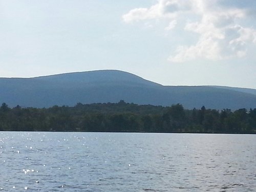
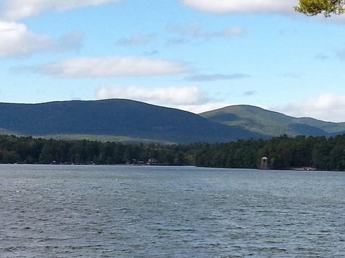
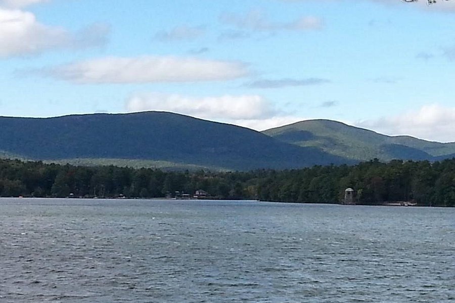
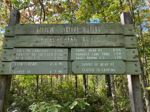
Bear Mountain is actually one peak on a range that runs fifteen miles or so north/south from Salisbury, Ct to Egremont, MA. The trail follows the ridge-line which is roughly one thousand feet above the valley floor. Ascending from the valley on the side trail that starts at route 41 is strenuous, and the round trip will take the better part of the day. There is a road that parallels the Appalachian Trail. It starts behind the town hall in Salisbury and ascends to the ridgeline along a deep ravine. The road is dirt but driveable in summer months and connects with the town's historic past as a center for iron mining in the 18th century. One the old blast furnaces can be visited at the head of the ravine. A few more miles north on the road brings you to the Ct/MA state line where you can park and hike east to the summit of Bear or west to other peaks on the New York, Connecticut border, including a westerly view of the Hudson valley and the Catskills. The mountain road is paved as you enter Massachusetts, and from there you can access the Mt. Everett Reservation or Bash Bish Falls on the New York side. In the spring of 2015 the road down to the falls from the top of the ridge was closed for repairs. This area is a wonderful resource for the community. However, hikers have gotten hurt or lost, so it is a good idea to have an up to date trail map. And to understand the limits of your stamina.