Wahluke Slope, Washington, United States
4.5 (5 reviews) Spent Ranking #6 in Tri-Cities Mountains • Beaches
Beautiful place.
If you want to see a beautiful place with abundant wildlife to view this is a great place! We often ride our horses here and what a blast!
Address
, Pasco, Washington, United States.
Current local date and time now
Friday, May 10, 2024, 8:55
User Ratings
4.5 based on (5 reviews)
Excellent
60%
Good
40%
Satisfactory
0%
Poor
0%
Terrible
0%
Reviews
-
5
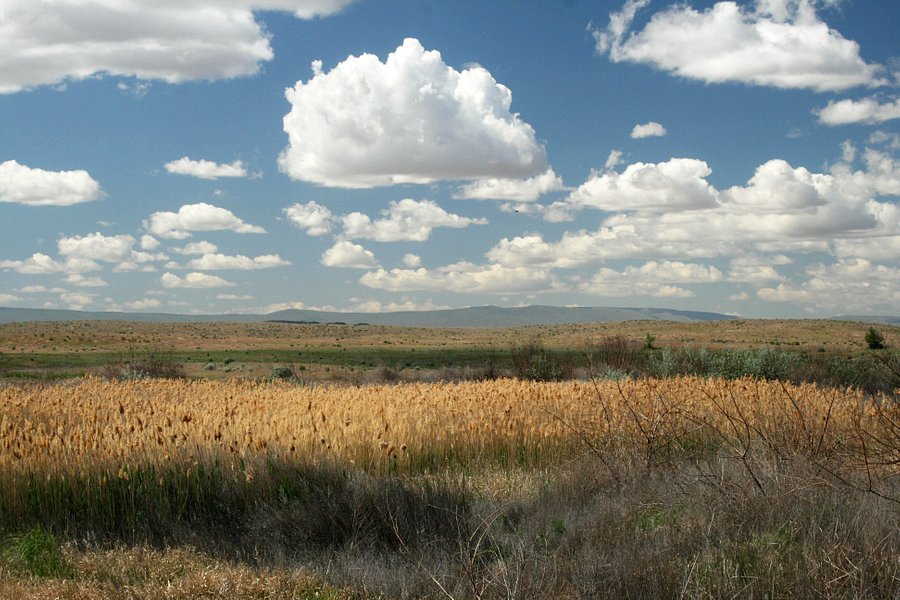
Wahluke Slope
The Wahluke Slope is a somewhat pristine plateau region located to the south of the Saddle Mountains in central Washington state, USA. It is sandwiched between the Columbia river and the crest of the aforesaid "mountains". One way to approach the Wahluke Slope is by way of Highway 24. Consult any good highway atlas. When you cross the river at Vernita bridge you are immediately confronted by a rather barren-looking escarpment, roughly 100 feet high. At this point you have a choice of highways to follow, all of which will conduct you through an interesting landscape of one sort or another.
If you follow the road to the right you will take a journey of many miles through the rolling sagebrush desert of the Saddle Mountain National Wildlife refuge.Here it shall become quite apparent to you why it is called Wahluke "Slope", for the land does indeed slope dramatically, though gradually, toward the crest of the Saddle Mountains. Beyond that crest, the road descends quickly into a region of irrigated farmland,and leads the touring motorist through the distinctive town of Othello, Wa.
Back to Vernita Bridge. To your left, you will observe a road that climbs diagonally up the barren escarpment. If you choose to follow this road you will find yourself upon a flat tableland that has been almost entirely reclaimed for agricultural purposes, although traces of the original sagebrush desert may be seen at intervals. If you keep going, you will eventually pass through the distinctive town of Matawa, Wa. prior to rejoining the main road that runs along the river.
-
5Craig U 5:00 PM Aug 12, 2015
This is an interesting, scenic and historic area.
You can either drive up the WWII era 1940's road to the top, and it's not that bad of a road considering having no maintenance for 75 years. Towards the beginning of the road, look for old military foundations and road curbing. At the top, head east and/or right to see two large foundation slabs with what looks like barracks. There's the remains of shower tile in a corner, and sidewalks leading around them. Go left at the top, then right again shortly after, and you can cross over Wahluke to highway 26 and come out near Royal City. (You need a Jeep or otherwise capable 4x4 though) Continue past that road to the radio sites gives a fantastic view of White Bluffs to the south. The turn off to head to north Wahluke is across highway 24 from the white Bluffs area. Go through the automatic solar powered gates to enter, but leave before dusk to avoid getting locked in.There are a few roads leading off east and west. One leads downhill to a boat launch. There's a cabin from the 1800's there, along with a neat old blue "Atomic Energy Commission" from the 60's or so in front of it. (It's the DOE - Dept. Of Energy now) The end of the main road is a turn around with views directly down on the White Bluffs themselves. Roads east lead to other old military foundations, and a reedy swamp area for wildlife and bird viewing. Both areas make for an easy day trip, and in the spring are bristling with wildflowers.
-
4Fishscales44 5:00 PM May 16, 2015
Make a right after Vernita Bridge
If you like natural nature, make the right after crossing the bridge, drive to mile post 63.3 - it's market, and turn right towards Wahluke Ponds and overlook. Although the road is gravel and sometimes washboard rough, the reward is the stark beauty of a land that has been untouched for 70 years. I would not suggest driving toward the ponds - upon arriving at the parking lot, signs inform you that you must walk another mile (probably really hot in summer), to actually get to the ponds. I did not.

-
4OutdoorBoomer 5:00 PM Nov 10, 2014
Love this AVA
I can usually bank on the fact I will like the red wine if the grapes come from this AVA. Yummy! It is a south-facing slope on the North side of the Columbia River at the base of Saddle Mountain.(See Mattawa and Vernita Bridge). There are some wineries here but many others just use the grapes from the area. Take a hike over-looking the White Bluffs or on Saddle Mountain in the spring or fall for some lovely views.