Rattlesnake Mountain Trail, Washington, United States
4.5 (135 reviews) Spent Ranking #1 in North Bend Hiking Trails
Early Morning Hike
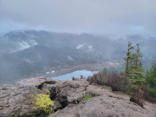
Great hike in early April. Overall all, total out and back my app showed over 5 miles, and 1125ft of elevation gain. It took my husband and I about 1hr 45min, including time for photos at the top and bottom of the trail. After reading reviews about how busy this trail gets, we arrived at the trailhead around 6:30am, and I'm glad we did. We came across very few on the trail (maybe about 10-15 different groups or individuals?). By the time we got back down, it was already SIGNIFICANTLY picking up in traffic. This early, it was foggy in parts and at the top, but still a beautiful view. I would definitely recommend if travelling to North Bend or to Seattle!
Address
Off I-90 near North Bend , North Bend, Washington, United States.
Mobile
Website
http://www.wta.org/go-hiking/hikes-of-the-week/rattlesnake-mountain-trail
Current local date and time now
Sunday, May 12, 2024, 23:16
User Ratings
4.5 based on (135 reviews)
Reviews
-
5capableengineer 5:00 PM Jun 6, 2017
"The bite is at the tail end of this snake...."
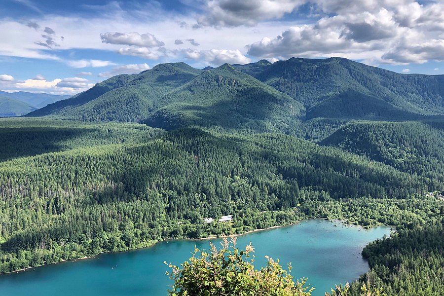
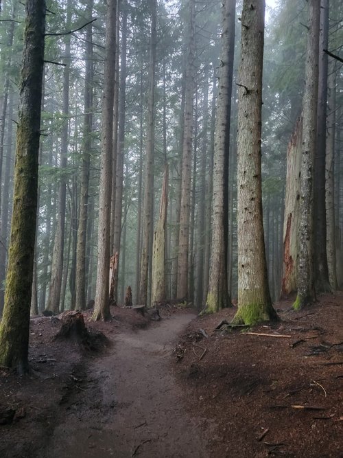
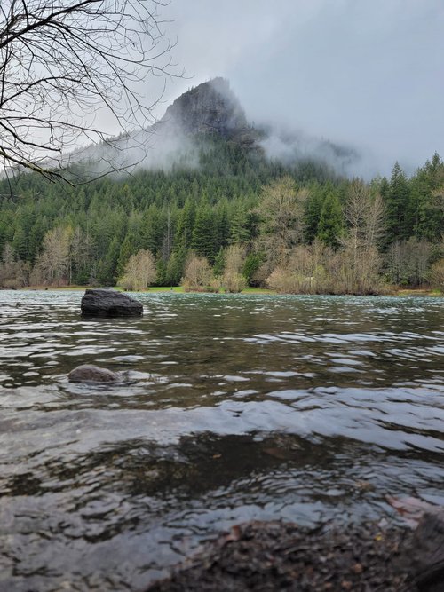
Dateline June 4th, 2017. Plan? Hiking to "Rattlesnake Ridge", an 1100 foot ascent on a hike of 1.9 miles (3.8 miles round trip), to a massive rock overlook that gives you a 225 degree view of the Seattle watershed, and Snoqualmie pass, through which the east - west transit of interstate 90 passes. The day for this adventure was cool and cloudy, not a "beautiful" day for a hike, but nonetheless, the coolness was welcome, as it would offset the "heat" of the climb. The large parking lot was already reasonably full at 10 AM, suggesting the visitor to arrive no later than this time, to avoid overflow parking. This is a popular, well groomed and worthwhile trail, especially in the Summer months, so prepare accordingly. Hiking boots, snacks, water, and trekking poles are all suggested, but at minimum, good footwear and water are a must. Prior to the trailhead, there is a wooden display that gives the interested viewer a great deal of historical information about the trails and surrounding area, and "porta-potties" are conveniently placed for those who have need. A sign at the trailhead itself neatly displays your choices. As a novice hiker, I chose the shortest of the three paths, though one can select a 4.3 mile (one way) trek to the East Peak, or an ominous 10.2 mile one way trip to Snoqualmie Point. To each their own, this is a delightfully optioned destination! As you enter the trail, you encounter a canopy of tall, thin pines, with the path covered in a bed of pine needles. There alongside the trail is a MASSIVE boulder that dwarfs tall folks as myself; nicely covered in moss, it sits formidable and undisturbed, as it likely has for thousands of years, well before people dreamed of creating trails up mountainsides. And OF trails, this one climbs quickly. Unlike other trails I've travelled, this trail is "straightforward", neatly wrapping its way upwards, but void of the dynamics of falling water, sharp rocks, boulder fields, or open parcels of light. This is not to suggest it is dull; it is not technical, but is steep, tucked neatly into a tall conifer forest. And, as I wound my way through the trees, I found the steep transition to be far more challenging than Lake 22 (visited last week), and had to stop many times to catch my breath and sip water. The trail ends almost abruptly, because of the short distance. Reaching the summit, you are greeted by both "steep cliff" warning signs, and a grand opening onto magnificent stones that have been carved by wind and weather, large enough to hold dozens of visitors with ease. Deep crevices create a few boundaries that must be carefully crossed, but do not prevent excursion to the outmost rim. The view is breathtaking and substantial, with mountains in the distance, a lake three hundred feet below, and the diminutive parking lot beside it, where the vehicles appear as grains of rice. Brilliant outcroppings of conical, reddish-pink flowers hug the vertical rock surfaces, and swaths of light violet floral patches can also be seen. Chipmunks and squirrels run amongst the visitors seeking out morsels of food. I stole my own glory from the rich visual portrait beyond, with the clouds playing against one another, allowing a stream of sunlight through, even for brief moments. The air became cooler yet; and tiny sprinkle ensued, but only for a very short time. There is a large boulder at the cliff edge that I stood upon, to have a photograph taken. And for the photographer, there is a near infinite selection of "fore" and backgrounds from which to choose, awash in a dynamic palette of color. Indeed, the "bite" is at the end of the trail. Vistas like these may be plenteous, but reaching them takes work. Rattlesnake Mountain Trail is well worth the effort, and I heartily recommend it to anyone willing to take a few hours of their time to see the splendor of nature on a big scale. Enjoy!!
-
4Alec D 5:00 PM May 25, 2019
Fairly easy hike with nice views
Rattlesnake Mountain Trail is an extremely popular hike. Which keeps me from doing it more often then I do. There are often large groups of hikers which can make it a challenge to navigate. I would recommend going during a weekday.