Upper Tremont Road in Great Smoky Mountains National Park, Tennessee, United States
5.0 (81 reviews) Spent Ranking #30 in Great Smoky Mountains National Park Hiking Trails
Best kept secret!
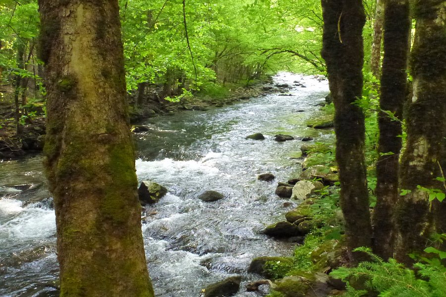
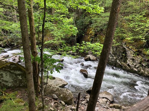
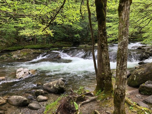
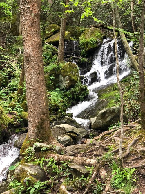
The selfish part of me does not want to share this with other travelers. The Upper Tremont Road is so quiet, so peaceful, hidden from most of the travelers. Yet, it has the most beautiful water fall, and streams. You can drive around by car. You can hike at the end of the road. You can fish by the stream, or you can sit on one of the rocks just to admire the beauty of the great smoky mountain that has to offer. There are plenty of options. I absolutely love it!
Address
Tremont Road, Tennessee, United States.
Mobile
Website
http://www.gsmit.org/
Current local date and time now
Monday, May 13, 2024, 12:53
User Ratings
5.0 based on (81 reviews)
Excellent
83%
Good
15%
Satisfactory
2%
Poor
0%
Terrible
0%
Reviews
-
5Fun4Me2Travel 5:00 PM May 28, 2021
Peaceful
A hidden gem among GSMNP. This road is half paved and half gravel. A beautiful slow drive along the river with random waterfalls and wildlife. The road was not busy at all when we were there late morning. The road ends in a dead end which is a trailhead for those who would like to hike. Lots of turnaround if you choose not to go the whole distance.
-
5Paul S 5:00 PM Sep 9, 2019
Hidden in plain sight
The turn for Tremont is immediately after the Townsend Wye on the road as it begins to ascend to Cades Cove. It is easy to miss and most people simply drive right past. Their loss. Just don't do what I did- I was watching bicyclists and traffic and turned into a parking lot directly across from the Wye by mistake. I carefully and quckly turned around and then turned on the Tremont Road, which is paved as far as the Tremont Institute. Just past the entrance, the road turns to a gravel surface as you begin the four mile deadend drive on the Upper Tremont Road. I was glad to see lots of people stopped along the way to fish and hike, not just whizzing through the woods like on the main park roads. The road is very scenic. It is gains altitude but slowly as it is an old narrow gauge logging railroad bed, and is graded so is passable in the lowest family sedan or sports car. The only real problem is finding a parking spot without a rock or tree at the poplular and crowded Middle Prong trailhead, which leads up four miles to Indian Flats Falls and junctions with back country trails. If you can't find a space, you can retrace your route to Tremont and take either the West Prong on Spruce Flats Falls trails. When you return back to the main park road, it will seem like you're on the Pigeon Forge parkway compared to the tranquility of the Upper Tremont Road.