Laurel Fork Falls, Tennessee, United States
4.5 (10 reviews) Spent Ranking #3 in Hampton Waterfalls
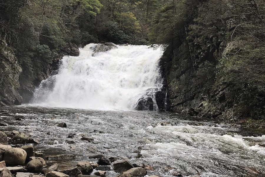
Beautiful waterfall
This was the highlight of our trip. We enjoyed the hike and waterfall so much that we went twice on our recent vacation. There are two different parking lots and hikes to the waterfall, we did both. The Laurel Falls Trailhead is moderate and about 5.5 miles. The Dennis Cove AT Trailhead hike is about 3.7 miles, starts out pretty easy and flat but ends with a long stretch of stone stairs. The waterfall was beautiful and definitely worth the effort.
Address
, Hampton, Tennessee, United States, Postal Code: 37658.
Website
http://www.fs.usda.gov/recarea/cherokee/null/recarea/?recid=35016&actid=50
Current local date and time now
Friday, May 10, 2024, 3:31
User Ratings
4.5 based on (10 reviews)
Excellent
70%
Good
20%
Satisfactory
10%
Poor
0%
Terrible
0%
Reviews
-
5Solo Nutiket 5:00 PM Dec 15, 2020
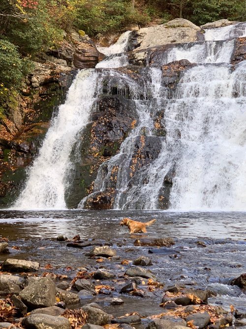
Hiked to Jed's swimming hole and rode the slide for hours
Two ways to get to the falls. From Hwy 321, the trail is longer and runs along the creek most of the way. A shorter hike is from Dennis Cove. Once you park and start hiking you are hiking on an old narrow gauge railroad bed. It was used for logging along the creek. When you reach the first hollow, the trail turns 90 degrees to the right and proceeds to a small bridge crossing the creek. Then, back up to the previous elevation. There use to be a small trestle there for the train to cross. A little further up the trail, there is a "cut thru" the mountain. This kept the train on a level grade. Just before the cut thru, step off the trail to the left and hike up to the top of the cut thru. Here you will see a small trail going off to the left. This short trail leads to the top of "Potato Top", which has a 360 degree view of the entire valley. Great place for lunch or a snack. Back down on the trail you walk farther until the trail turns left and down a very steep trail to the falls. Going back up this trail I called it the "Cardiac trail", as it really gets your heart rate up. If you are hiking during July or Aug, you can hike up the right side of the falls (your left). Very testy, but worth it. You can wade up the creek, or look for a small animal trail. Continue until you find Jed's swimming hole. You will not be disappointed. The water is always cold
-
4RBonTheLake 5:00 PM Oct 31, 2022
Great waterfall!
We accessed this off 321 which makes it a longer hike than what most people I’ve read do. It was a beautiful fall day and a wonderful hike along the river. The signs are great when you start the hike, but it was tricky at times to find where to go further along. The falls are great and it’s well worth the trip. Took us a little over 2.5 hours to the falls and back staying at the falls to enjoy them for a while.
Spread the word 


See also
More Things to do in Hampton
- Architectural Buildings in Hampton
- Historic Sites in Hampton
- Religious Sites in Hampton
- Parks in Hampton
- Historic Walking Areas in Hampton
- Gardens in Hampton
- Nature & Wildlife Areas in Hampton
- Spas in Hampton
- Taxis & Shuttles in Hampton
- Scuba & Snorkelling in Hampton
- Bodies of Water in Hampton
- Theaters in Hampton
- Zoos in Hampton
- Beaches in Hampton
- Escape Games in Hampton
- Farms in Hampton
- Shopping Malls in Hampton
- Water Parks in Hampton
- Amusement & Theme Parks in Hampton
- Bus Services in Hampton
- Golf Courses in Hampton
- Art Galleries in Hampton
- Sports Complexes in Hampton
- Lighthouses in Hampton
- Distilleries in Hampton
- Air Tours in Hampton
- Auto Racing Tracks in Hampton
- Boat Rentals in Hampton