Cumberland RIver Bicentennial Trail, Tennessee, United States
4.5 (30 reviews) Spent Ranking #1 in Ashland City Hiking Trails
Awesome place to walk or bike!
This is a glorious place to spend an afternoon enjoying the trail. It is almost magical in it’s beauty of a shaded and paved hiking trail. An absolute gem in the beauty of nature! I highly recommend this adventure if you live in Ashland City or just visiting!
Address
Chapmansboro Road, Ashland City, Tennessee, United States.
Mobile
Website
http://cumberlandrivertrail.org/
Current local date and time now
Sunday, May 12, 2024, 10:01
User Ratings
4.5 based on (30 reviews)
Excellent
70%
Good
27%
Satisfactory
3%
Poor
0%
Terrible
0%
Reviews
-
4eatmoresalmon 5:00 PM May 30, 2014
Totally Shady No Hills Bike Ride
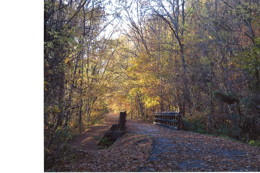
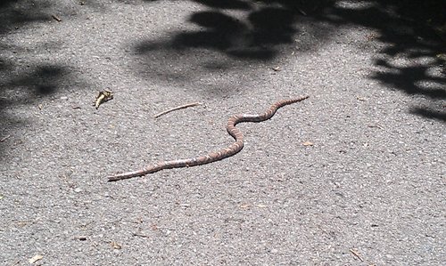
This is an old railroad route that has been converted into a paved bike trail. It starts just outside of Ashland City, TN with a nice parking lot that will hold over 20 cars. There is one porta-potty there. The trail itself is under heavy shading from tall 100 y.o. trees that completely cover it. The trail has the river on one side and a steep hill on the other. The steep hill provides some of the shade as well. Even when it is over 90 degrees outside on your back porch it is very comfortable to ride your bike on this trail. It is smooth for about 3 miles and then the asphalt is rooty for the final mile. There are two old rail road bridges that you can cross and that adds some variety and scenery. I have see some hikers swim from the bridge to cool off in the muddy Cumberland river below. Today there were 3 little lizards and one colorful snake. You can hear a lot of different birds making their calls in the canopy above you. I have seen camera clubs hiking out there at times. There is one bathroom building along the way but a few years back it was not well kept. I didn't check it out today. There are a couple of little streams for kids to wade in or explore along the way. At the end of the asphalt trail there is another stretch that goes another 4 miles or so that is called Eagle Pass Trailhead. Supposedly there is an Eagle's nest out there somewhere, but I have yet to see it. At that point there is a paved 2 lane road that you can take back to the original starting point at Mark's Creek Trailhead. It runs along more of the river and through a little resort area. This is a little different kind of scenery. There are large cornfields on the inland side and there are boaters on the river on the other side. That would be on Chapmansboro Road. If you take the gravel trail you will finally get to another campground that goes all the way to the dam. That round trip should get you about 19 miles. There are no hills and a lot of shade. Bike, stroll jog or run. I guess you could even roller blade the first 4 miles.
-
5chicpower 5:00 PM Apr 10, 2015
This is a gem you should not miss!
I love everything about this trail. You may begin from either end. The southern end is scenic and beautiful, and Turkey Junction (with restrooms and picnic tables beside a creek) is only a mile away. On the northern end, it is more secluded but the bonus is you are within 1/4 mile of a large, beautiful, wooden bridge that crosses over the Cumberland River. The northern end also has an unpaved trail, Eagle's Pass, on the opposite side of the parking lot that is several miles long and ends at the Cheatham Dam. I have walked the entire trail from the dam to the southern end and love every bit of it. Wonderful for family, biking, skating, walking, strollers, etc.