Santa Fe Trail, Oklahoma, United States
3.5 (6 reviews) Spent < 1 hour Ranking #5 in Kenton Hiking Trails
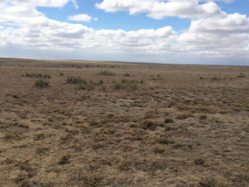
Not a lot to see except open space
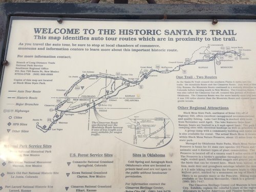
The branch of the Santa Fe Trail that crosses Cimarron County is an old remnant, of course, and grasses have overtaken the trail, erosion softened the ruts, so actually it's easier to see on Google Earth. Still, if you can manage a visit to Signature Rock on private land, but protected by the National Park Service, that is an extra treat. It is along a spring on the trail with a sandstone bluff where travelers on the trail engraved memorials to those who perished on the journey. Very inspiring.
Address
Hwy 325 NMex 406, Kenton, Oklahoma, United States.
Website
http://www.blogoklahoma.us/place.aspx?id=282
Current local date and time now
Wednesday, May 15, 2024, 21:04
User Ratings
3.5 based on (6 reviews)
Excellent
34%
Good
0%
Satisfactory
33%
Poor
33%
Terrible
0%
Reviews
-
3redlandfd 5:00 PM Mar 23, 2016
Santa Fe Trail Crossing
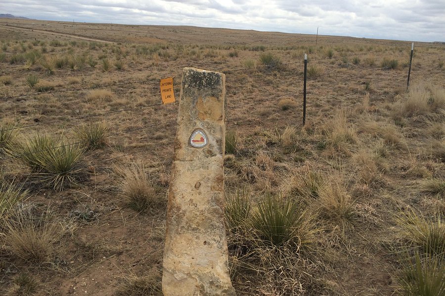
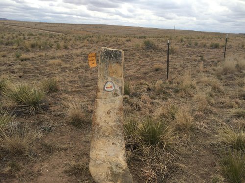
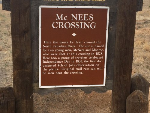
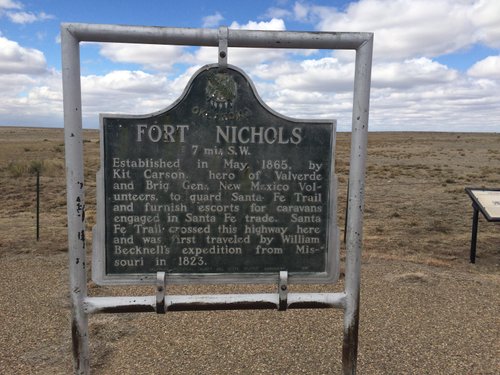
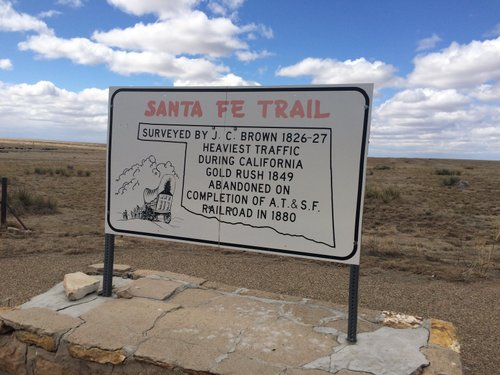
On the road to Black Mesa and Kenton, which is Hwy 325, the Santa Fe Trail crosses the Highway. There are a couple of roadside markers and a sign that explains the trail. After you leave Kenton, travel west into New Mexico and turn south on Hwy 406 towards Clayton, NM. Follow this Hwy along the border and you will intersect the Santa Fe Trail a couple of more times. At the Hwy 410 intersection and another about a mile south at McNees Crossing. There is a sign and you can make out the ruts. For a hike along the actual Santa Fe Trail, continue on NM 406, it will intersect with a dirt road A055. There is a large sign that says "Interpretative Center" follow the road about 3 miles, it will turn north and you will come to a roadside park. There are signs there that direct you to the trailon both sides of the road to the north. Go north 100 yds then on the rightis a 12ft green farm gate. You will have to open the farm gate, but its okay, its public property, just be sure to close the gates behind you as you walk the trail, cattle graze there. Follow the jeep trail to a stone post/marker, then look northeast for the next one about 500 ft apart. You will begin to make out the low ruts in the land, that's the trail. Follow it marker to marker. This is a good side trip for Black Mesa Visitors
-
3okiesooner09 5:00 PM Apr 27, 2021
worth a photo stop
There is a highway marker about the Santa Fe Trail crossing here. There really isn't any sign of the trail. It is worth a quick photo stop.