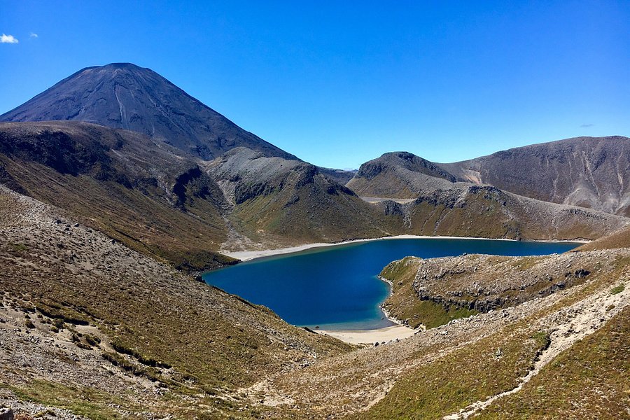
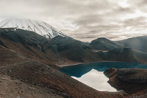
Tama Lakes, North Island, New Zealand
5.0 (95 reviews) Spent More than 3 hours Ranking #2 in Manawatu-Wanganui Region Bodies of Water
Why doing the crossing?
Always check the website for changes that might affect your trip.

Address
, Whakapapa, New Zealand.
Mobile
Website
http://www.doc.govt.nz/link/c10e3e79bed84e329e140a53f90dabe2.aspx
Current local date and time now
Friday, May 10, 2024, 9:48
User Ratings
5.0 based on (95 reviews)
Excellent
82%
Good
17%
Satisfactory
1%
Poor
0%
Terrible
0%
Reviews
-
5Daniel 5:00 PM Jan 14, 2020
Why doing the crossing?
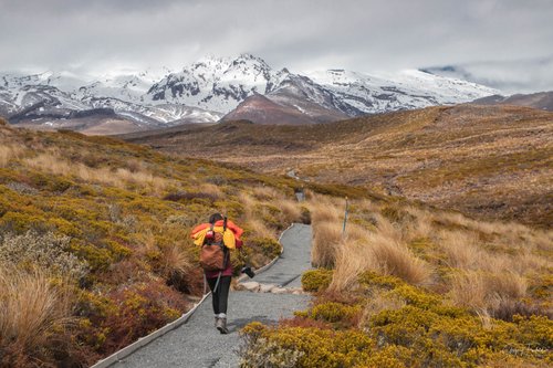
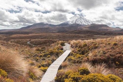
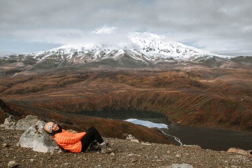
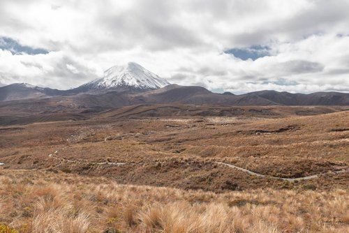
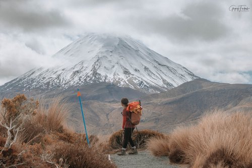
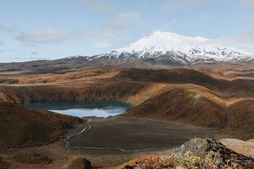
We were thinking about doing the Tangariro Crossing. After people told us you walk with 1000+ people, you pay 40NZ$ per person for a shuttle and there are places you have to wait in queues, I was looking for a alternative. We found Tama lakes which is just on the other side of the Ngauruhoe, so you have more or less the same views. We weren’t disappointed. The views were incredible! We saw a couple of hikers but no more then you see on other hikes. Honestly, after that hike I don’t get why you should pay for a hike AND walk with thousands of people’s when you have beautiful free alternatives where way less hikers. We parked for free in Whakapapa Village where are more then 100 free parking spots you cannot miss.
-
5Christina N 5:00 PM Feb 22, 2020
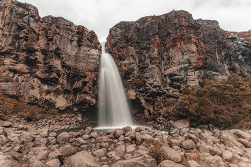
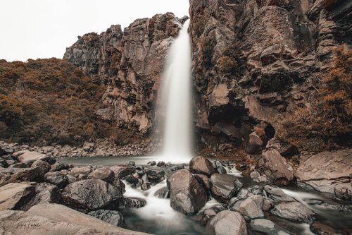
Amazing day!
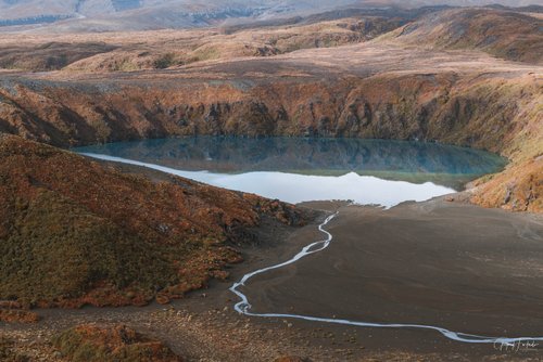
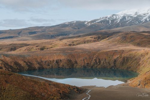
We had planned to do the Tongariro Alpine Crossing but it was too windy and this was recommended as an alternative. In retrospect, I think we ended up having a better day than we would have on TAC, seeing as how crowded TAC seems to be. We started around 8.30 and took the lower circuit to Taranaki Falls in order to see the waterfalls (keep left to get on the lower circuit). First part of the track is through forest and after 40 minutes or so you reach Taranaki Falls, just beatiful! We then continued on to Tama Lakes. The road is fairly well paved in most places and not too steep. All the way you have incredible views over the national park including Mt Doom. We met a few other hikers but it didn't feel crowded at all. First, we reached the Lower Tama Lake. From there it is an uphill climb on a gravel track to Upper Tama Lake. A bit tricky but not too bad. Anyone who is of average fitness can manage this. I have quite a lot of vertigo and found some parts to be a bit scary but made it to the top. The views from the top are truly amazing! What an incredible view! Then you unfortunately have to go back the same way, which I think is the main (only?) drawback of this track. I really recommend this track to anyone who wants an alternative to Tongariro Alpine Crossing that is a little bit less crowded, less streneous, if you are unsure of your fitness level, or if the weather conditions prevent you from TAC. There are toilets at upper Taranaki falls (they are hidden when you come from the lower falls and continue to Tama Lakes, so we didn't see them) as well as just before lower Tama Lake. We did the walk in running shoes which was fine. It's mainly the last part to Upper Tama Lakes where you would benefit from hiking shoes, but it's manageable to do in trainers as well.