Nantucket Founders Burial Ground, Massachusetts, United States
5.0 (11 reviews) Spent < 1 hour Ranking #34 in Nantucket Points of Interest & Landmarks
Must see if you want Nantucket history
It was like a treasure hunt to find the Founders cemetery. But after a bike ride to Cliff road we found this place. Almost impossible to see markings. But look for a pull out with a pond. Then hike up the gravel road to the gravestones. I had to go because my great grandparents Peter and Mary Folger. Some of the first English to inhabit the island are here. It looks like a restful place but there is a huge structure being built on the edge of the cemetery. Maybe a mansion.
Address
Cliff Road, Massachusetts, United States.
Current local date and time now
Tuesday, May 14, 2024, 0:28
User Ratings
5.0 based on (11 reviews)
Excellent
91%
Good
9%
Satisfactory
0%
Poor
0%
Terrible
0%
Reviews
-
5GGDesMoines 5:00 PM Oct 25, 2013
This is where Nantucket started.
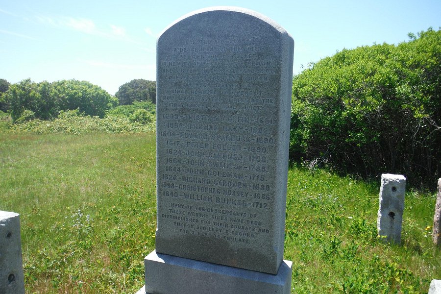
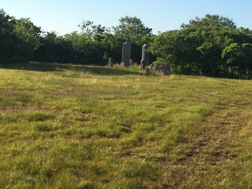
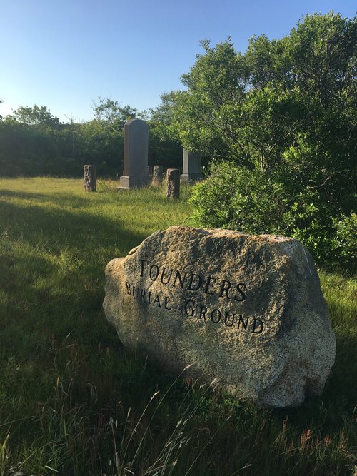
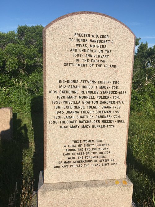
This tiny cemetery will never be a top attraction, but is of interest to the very large number of decedents of the founders. It is convenient to town and at the original 1659 settlement location. The Founders Burial Ground is a small plot of land located off Cliff Road and overlooking Maxcey's (Macy’s) Pond and contains three engraved stone markers. A large one lists and represents the original male settlers. Another one lists and represents their wives. The smaller third stone is a replica of John Gardner’s stone; the original residing with the Nantucket Historical Association. It is shown on some Island maps, but directions are helpful. From downtown Nantucket, go west about 2 miles on Cliff Road passing the large tall water standpipe (water tower) on the north. There is paved bike path along Cliff Road much of the way. Follow Cliff Road downhill about 500 feet more to a small sand/gravel road and sign by Maxcey’s Pond. The cemetery is about 250 feet up this road hidden by some trees on the left. The original 1659 settlements were around Capaum Pond and extending to Maxcey’s (Macy’s) Pond. This was Capaum Bay until the ocean entrance silted in and it became a pond. The settlement was then moved east to the current harbor location. A good and somewhat unchanged view of Capaum Bay/Pond is available on public property. Go back on Cliff Road to the large tall water standpipe and take the paved Washing Pond Road north toward the ocean past many home driveways. Continue on the same paved road as it makes a left curve west. After about 600 feet going west on the paved road, the paved road makes a 90 degree left turn becoming Old Harbor Road. At this 90 degree turn a small lane of sand continues straight ahead west. Path might be a better description than a lane. There is a cement post that says “Public Way”. Don’t confuse it with a private home driveway that is wider, better, and much more kept up just to the left. Take this sandy Public Way 600 feet down to the ocean. Climb a dune to overlook what Capaum Bay probably looked like when first settled. Most locals don’t know how to get here.
-
5wood_boyer 5:00 PM Sep 24, 2014
Tristram Coffin is here!
We explored thes place last week-end, only because I'm a Tristram and Dionis Coffin descendant (11 generations). The Founder's cemetary is just a short distance fro the site of Tristram's homsttead. The monument here was erected in 1881 at the time of the Coffin family reunios remembering Tristram 1681 death. The original ten founders who came down from Newberry Port are all here. The ten couples produced eighty children! This is only for history buffs. It is hard to find and really not much to see.