Sacagawea Springs, Montana, United States
4.0 (8 reviews) Spent Ranking #21 in Great Falls Bodies of Water
Hike to Sacagawea Springs
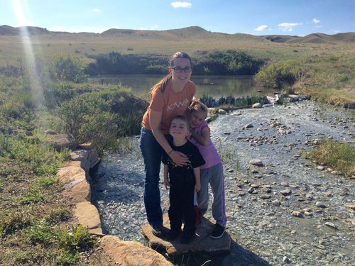
This is a bit of a long trail for small kids (4 miles round trip) but my kids (ages 3 and 6) did pretty well. There were a few steep places and a couple places near the edge of a drop off. Once in a while the trails confused us. There was lots of little trails, but they all basically lead to the same place, so it all worked out. We had a great time!
Address
Morony Dam, Great Falls, Montana, United States.
Current local date and time now
Sunday, May 12, 2024, 23:32
User Ratings
4.0 based on (8 reviews)
Excellent
12%
Good
75%
Satisfactory
13%
Poor
0%
Terrible
0%
Reviews
-
4D.Farkswald 5:00 PM Jan 6, 2014
A (short) walk on the wild side
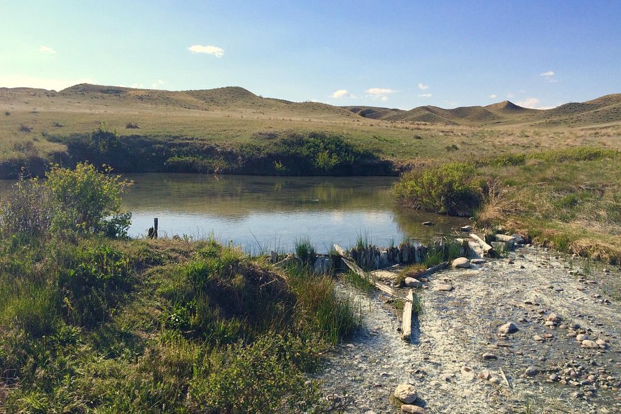
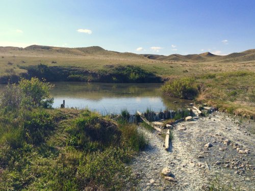
This short hike (about a mile each way) to the springs is level for the most part across the slopes of hillsides on a narrow and rocky path with a couple ravines to descend and then climb back out. There are no trees but plenty of grassland and scrub brush. The views of the Missouri River and surrounding hills are outstanding and the absence of buildings or anything else to mark mankind's presence makes the view even more stunning if you pause to realize this is exactly what the Lewis & Clark Expedition saw on its travels through here in 1805. It was just downstream from here (where the Marias River joins the Missouri) when the expedition's Indian guide and translator, Sacagawea, came down sick with an unknown abdominal malady in early-June of '05. Laid up for days, she was treated with opium and then bled by Captain William Clark (the feed 'em and bleed 'em regime for illnesses at the time). When that failed to work, Captain Meriwether Lewis, who had just returned from a trip upstream, sent some of his men across the river to procure water from a sulphur spring they had discovered en route to locating the Great Falls. Lewis fed the medicinal spring water to her and she began to recover the following day. Today, the spring remains just as it was when discovered by Lewis and his men. The water flowing out of the spring forms a large pool where green algae can be found in abundance. And there's a slight smell of sulphur in the air. The trail circles the spring and there are several places where a picnic can be had (upwind) in what might be considered a very pleasant setting. One caveat: This is rattlesnake country so it helps to bring along a walking stick to even the field of play. (The snake still retains a small advantage in that the contest has generally already started before you are even aware you're in it!). Here's how you get to the trailhead: From Great Falls take Highway 87 towards Havre. Turn east (right) onto the county road to the Ryan Dam Picnic area. (the turnoff is well signed). This is also the road to Morony Dam. Follow the road past Ryan Dam to the Morony Dam parking lot with a large red house. The trailhead is there and marked with a sign. The drive, hike and return can all be done in a half-day, making this one of the more interesting hikes around the city. And you will probably be by yourself the entire time. There are Forest Service restrooms at the trailhead.
-
4washmont 5:00 PM Aug 18, 2014
Long hike. Beautiful views.
The hike from the parking is 1.5 miles each way. Plan ahead. We ran into a rattlesnake on the path, so be prepared. The view while hiking are outstanding. If you are not a begin hiker, I'd avoid. Parking is free. The is an outhouse at the parking area.