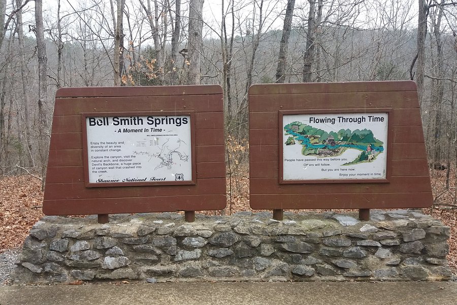
Bell Smith Springs, Illinois, United States
4.5 (9 reviews) Spent Ranking #1 in Ozark Hiking Trails
Peaceful hike
Gorgeous area with a few short hikes to choose from. The natural bridge was stunning and the teal blue water was unique. I recommend the Devil's Backbone hike and Natural Bridge hike. Seems like it would be a great place to take a dip in the summer heat, but it was still too cold for us to do that. Definitely stick to the trail as there was A LOT of poison ivy.
Address
Bell Smith Springs Road, Ozark, IL 62972
Website
http://www.fs.usda.gov/recarea/shawnee/recarea/
Current local date and time now
Saturday, May 11, 2024, 20:58
User Ratings
4.5 based on (9 reviews)
Excellent
67%
Good
33%
Satisfactory
0%
Poor
0%
Terrible
0%
Reviews
-
5robin r 5:00 PM Oct 21, 2022
beautiful area
we did the yellow trail to see the natural bridge. says 1.5 miles but it feels longer than 1.5 miles. 5 year old and 8 year old were able to do it without being carried. there are areas where you can fall of course. the trail narrows in some areas and there are trees to climb over or under. the natural bridge was cool from the bottom and the top. we saw a dead armadillo. some others there said they saw one alive. we also saw an eastern milksnake sunning himself on the rocks at the top. some tiny white spiders and prickly pear. the water was very low when we went still blue in color (drought) so our feet did not get wet crossing the creek. but in spring they will definitely be wet. there is one small main parking area. park there and walk to the bottom of the stairs then pick trail. the stairs are harder to see on the way back out because the sign is gone from that direction. there were a few times if we wondered if we were still on the trail but it was fine- not long after we would wonder we would see another yellow diamond on a tree letting us know we were still on the trail . * the metal rung staircase is a shortcut. we missed it. it is located on the RIGHT side at the bottom of the natural bridge. so when at the bottom of the natural bridge you can either go to the right to the metal rung stairs as a shortcut or go left on trail and get to the top of the natural bridge that way. * you will see part of the blue trail by doing the yellow trail. yellow trail goes down 2 staircases and then across creek to the natural bridge. then you can choose to turn around and leave if you only want to see the bottom of the natural bridge, or you can take the shortcut on the right (metal staircase) or go around to the left and up top. trail narrow at times but we didn't see any poison ivy in October. for a cool photo under the natural bridge -select Pano on your phone...then turn phone sideways & pano going Up. then you can get people under the natural bridge and the top of the natural bridge on 1 photo .
-
4Sherry C 5:00 PM Apr 29, 2022
Another great hiking experience.
Another great stop within the Shawnee area. We hiked the area near the main parking lot first and took 'the stairs' down and continued on the trails. Very nice trails and scenery. The color of the 'blue' water was intriguing. We did a few other short trails and then went to the picnic area for a bit more hiking. We crossed one area of water with nicely placed rocks, and then when coming upon other creeks, without nicely placed rocks, we opted not to cross, as I wasn't prepared to get my feet soaked, so we walked on trails on only one side of the water, but still a nice hike. We stopped and talked to another hiker who told us this was the best hike in the area, but she was prepared with water shoes and had her socks clipped to her jacket. Maybe next time we'll be better prepared. There was also a small family cemetery on the road leading to the picnic area. It had a mailbox by it -- that amused me and I snapped a picture.