Ice Lakes, Colorado, United States
5.0 (29 reviews) Spent Ranking #10 in Silverton Bodies of Water
Bucket list hike
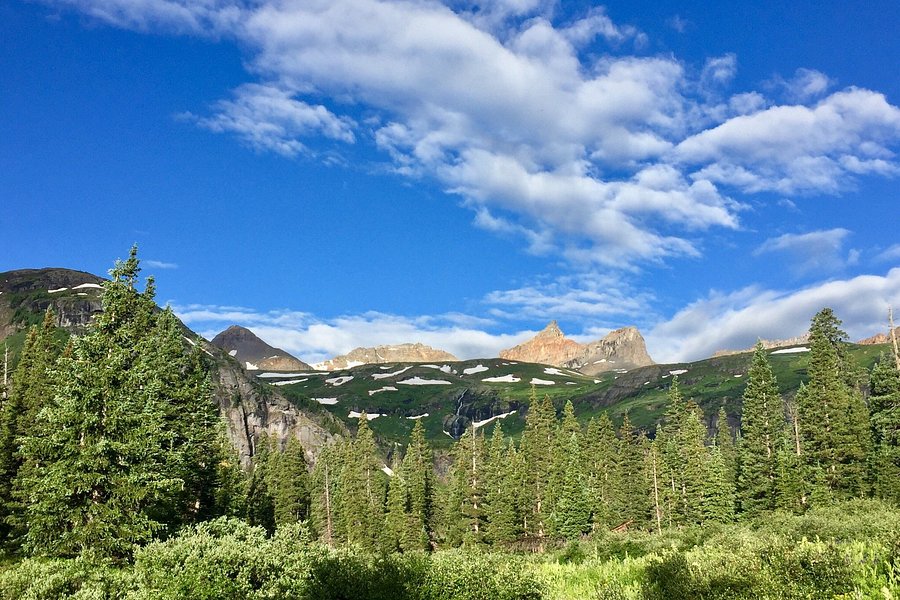
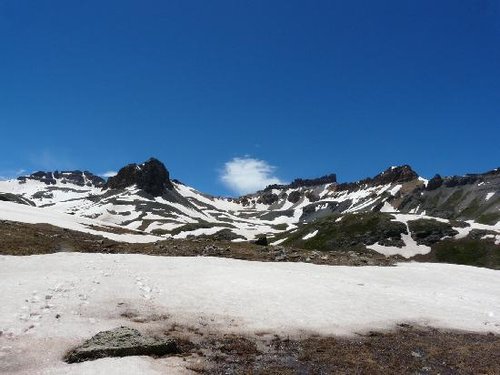
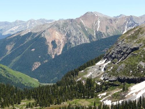
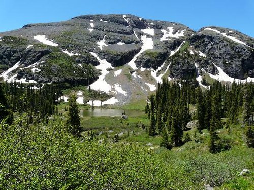
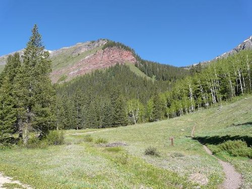
High-altitude basins in Colorado's San Juans offer excellent hiking opportunities.
Address
, Silverton, Colorado, United States.
Current local date and time now
Thursday, May 09, 2024, 16:43
User Ratings
5.0 based on (29 reviews)
Excellent
94%
Good
3%
Satisfactory
0%
Poor
0%
Terrible
3%
Reviews
-
5Scott 5:00 PM Jul 3, 2010
Great hike & amazing scenery
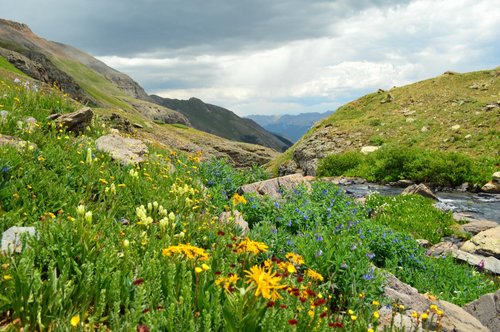
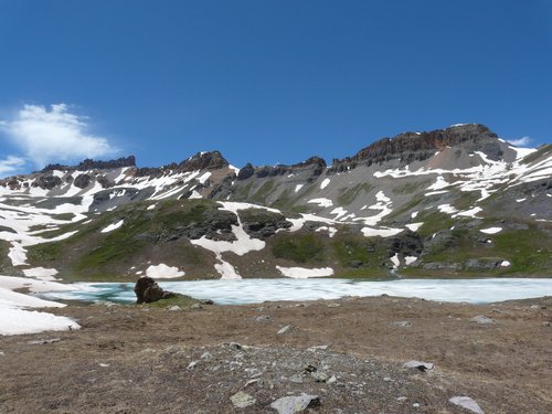
Summary: This hike gives you "Mother Nature" at her best. Great views, great exercise, summer at the bottom & winter at the top (June 19 = snow remaining & the lake mostly frozen). It did lack wildlife. If your not very fit (i.e. not used to the altitude & elevation gain, this is a tough hike - but doable). If you're fit, this is a great hike (not very technical) for it's distance, scenery & quality of exercise. Our experience: We (wife & I) were not very "physically fit". We took 3 hours to ascend the trail (not including a half hour snack & rest break). We came down in about 2.5 hrs. The views are amazing with many mountains, streams, waterfalls and plenty of flora (very little wildlife). The 1st half of the hike had quite a bit of shade; but the 2nd half did not have any; so remember hat, sunglasses, sunscreen & drinking water Directions: - go 2 miles north of SIlverton, CO on Hwy 550 (towards Ouray, CO) and turn left onto County Rd. 7 (heading to South Mineral Campgrounds) - go approx. 4 miles on Co. Rd. 7 and the trailhead parking is on the right (the parking lot & trailhead are well marked/labelled) directly across the road from a campground - the trail gains approx. 3000 ft in elevation (approx. 9,000 to 12,000) over 3.5 miles (7 to 7.5 miles round-trip) Facilities: - there are no outhouses/restrooms to use on the trail. These facilities are available in the campground right across the street from the trailhead parking. - there are no formal campgrounds on the trail; but there are many places for primitive camping (we think backpacking up there would be fun) - water - I do not no the quality/safeness of the water; but there are many running streams along the trail Other: For the most part the trail was well marked; but we did use the comments/directions/waypoints in this link ( http://bicycling.trimbleoutdoors.com/ViewTrip/515724 ) and they were very helpful (especially on any tricky parts).
-
5Linda O 5:00 PM Jul 7, 2012
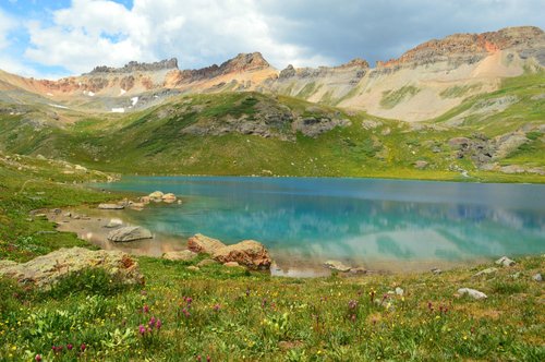
Bucket list hike
There are no real signs to the trail. You must turn into the mineral creek camp ground, the road is #585, and drive until you see a switchback/road labeled clear lake. You need a four wheel drive to access this road. Stop at first major switch back and park on the elbow of the road. This cuts off 500 feet of elevation or half mile of hiking. Trust me you need this help. Elevation starts at 9800 and tops off at 12260. Trail is straight ahead and walk to the right. Take water and snack or lunch to regain your energy for your return trip. This hike is strenuous if you are not physically fit. It is a 2.2 mile to lower basin an additional nasty mile to reach upper ice lake. The last mile is all up hill with many switch backs. You start in timber and work your way beyond timberline, so bring a jacket/rain poncho. Most likely to rain in afternoon. Wild flowers all over, water falls are plentiful with great views of the mountains. When you reach to top it is sooooo worth it. The lake is feed by a glacier which creates a beautiful blue color. Only a few in the state of Colorado let alone the country. This was a bucket list for me and my husband.