East Bay Regional Park District, California, United States
5.0 (109 reviews) Spent Ranking #12 in Oakland Bodies of Water • Parks • Scenic Drives
Go East
The official designation given to the numerous parks found in Contra Costa and Alameda counties.
Address
Take 80 from Richmond, Oakland, CA 94605
Mobile
Website
http://www.ebparks.org/
Current local date and time now
Sunday, May 12, 2024, 9:22
User Ratings
5.0 based on (109 reviews)
Excellent
83%
Good
12%
Satisfactory
3%
Poor
1%
Terrible
1%
Reviews
-
5Tom B 5:00 PM Jan 1, 2014
Convenient for folks in the East Bay, and worthy of exploration by residents living further away
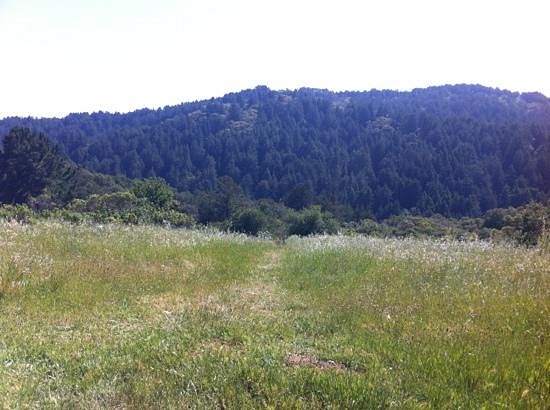
East Bay Regional Park includes many, many miles of hiking trails. One cluster of hiking trails is located in a deeply cut valley that extends from the area of Chabot Science Center in a direction that is generally north to south. The valley extends in the north-to-south direction, where the head of the valley is located at the northern end, near the Chabot Science Center, and the foot of the valley is located at a parking lot just off of a remote, little-traveled road that travels from Hayward to Orinda. There are three main trails: (1) Stream Trail, which travels through the V-shaped bottom of the valley and ends in the vicinity of the Redwood Gate parking lot; (2) East Ridge Trail/Canyon Trail, which travels along the eastern ridge of the valley, and then plunges by way of the Canyon Trail to the Redwood Gate parking lot; (3) West Ridge Trail/French Trail, which travels along the western ridge of the valley, and then gently descends in elevation and ends at the Redwood Gate parking lot. Both of the ridge trails have several connecting trails that plunge down steep trails that connect to intermediate parts of the Stream Trail. In particular, the West Ridge Trail has the most interesting connecting trails. These are the most interesting because they are steepest, and because the scenery is enshrouded in darkness. In contrast, the view along the East Ridge Trail is mostly of "weeds." (This is not to dismiss the subtle beauty of these "weeds." The billions and billions of twigs, thin branches, and stalks, that make up these "weeds" provide a fascinating study of textures, rivaling the most fascinating of photographic images that have been made of the surfaces of lakes, ponds, and oceans.) Stream Trail is the most popular of these trails. Stream Trail is a wide trail that is frequented by families with their children and dogs, and by occasional joggers. Stream Trail provides many beautiful viewpoints of the steep valley walls coated with millions of ferns, and views of oak trees with their octopus-like multiple trunks. At about the half-way point on the Stream Trail, where there is an intersection with a connecting trail, there is a cluster of logs and fallen branches that is usually coated with thousands and thousands of ladybugs. I have traveled the Stream Trail on about eight occasions during the past dozen years, and each time have seen the logs coated with thousands of ladybugs. Further on down the Stream Trail, are two or three small structures, suitable for use in gatherings, picnics, and birthday parties. The entire trail system is well-groomed by management, and the hiker will likely pass many freshly trimmed tree branches, laying on the ground to the sides of the trail. The general idea of this trimming, is to keep the trail free and open, and also to reduce the risk of injuries. Additional treats for the hiker include the occasional mushrooms, occasional horses, and views of the distant mountains further to the east. And yes, there are plenty of redwood trees to admire, but none are as thick and tall as those found in Armstrong Woods State Park or at Muir Woods.
-
4PSCC 5:00 PM Jun 4, 2012
Redwood Regional Park provides an alternative to Muir Woods to see redwoods
If you're staying in Oakland & don't have time to travel to Muir Woods to see the redwood trees, Redwood Regional Park is a good alternative (plus it's a lot cheaper, they just charge $5 per car on weekends). Although the trees aren't as big or tall as the trees at Muir Woods, they are still large. Take the Stream Trail for an easy level trail by the redwoods. If you're looking for a more strenuous hike, take any of the other trails that offer changes in elevation.