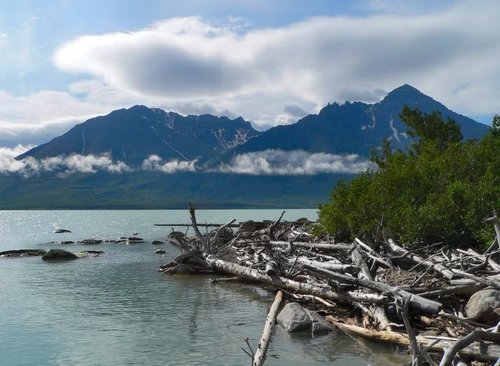
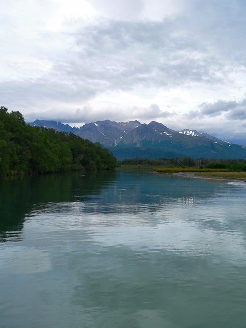
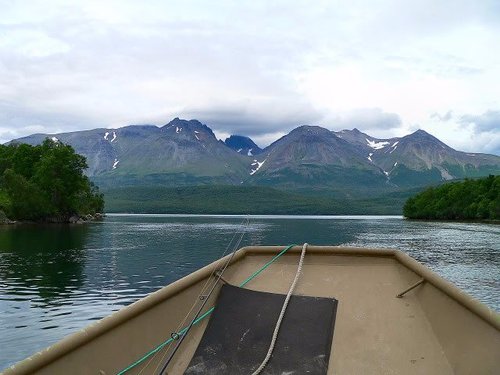
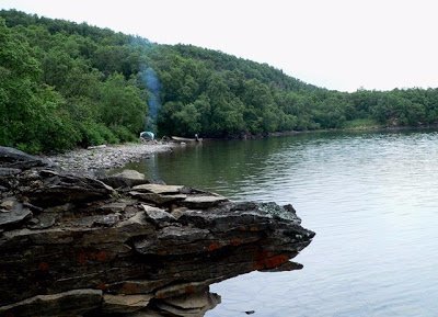
Savonoski Loop, Alaska, United States
5.0 (4 reviews) Spent Ranking #6 in Katmai National Park and Preserve Bodies of Water

The Real Alaska
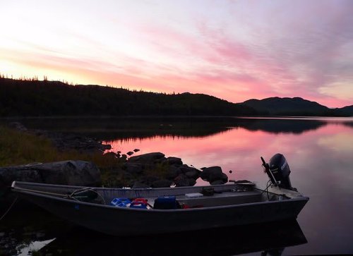
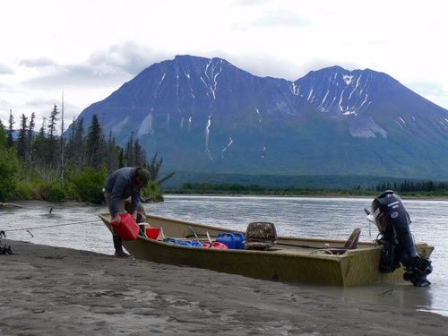
A five- to ten-day paddle route around the park.
Address
, Alaska, United States.
Current local date and time now
Tuesday, May 14, 2024, 6:53
User Ratings
5.0 based on (4 reviews)
Excellent
75%
Good
25%
Satisfactory
0%
Poor
0%
Terrible
0%
Reviews
-
5Footprints25003 5:00 PM Sep 12, 2004
A Great and Challenging Trip!
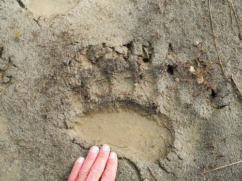
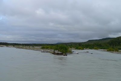
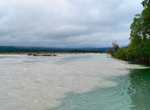
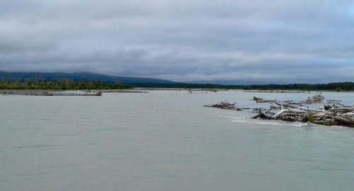
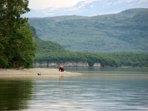
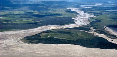
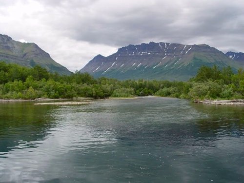
Canoeing this 80 mile loop is THE way to experience the Alaskan wilderness! It is not, however, for a beginner. It can be rainy with poor visibility, as it was the first 2 - 3 days of my paddle, and made orienteering the Bay of Islands difficult. The portage trail is long and strenuous. If you have the extra cash, have a plane drop a canoe at Grosvenor Lake and then take you to it. That way you avoid the portage trail. This, however, will make your trip considerably shorter. In my opinion, Grosvenor Lake is the more scenic part of the trip (although my opinion is biased because it was raining almost the whole time on the first leg of Naknek Lake). But, the views are AMAZING, the wildlife is everywhere, the fishing is great and I can't wait until I have another opportunity to do it! Just make sure you have good rain gear, a portable GPS is helpful, and follow ALL the bear precautions that you are told about at Brook's Lodge....because there are a LOT of bears! Just wanted to add that when you get to King Salmon, the charter plane company that I used to get to Katmai was C-Air. They are great people! When I was done with the canoeing, I met some locals at the "bar" at brooks lodge. When I got back to King Salmon, Phil (the pilot) drove my friend and myself to the city of Naknek (on Kvichak Bay) to meet up with the new friends. This is a 30 mile drive (each way) and it was about 10 o'clock at night! It was a great time and the people at C-Air made it even better.
-
4Ed M 5:00 PM Jul 20, 2015
Great adventure, not really for beginners though!
I did the full loop in 7 days in early July 2015 with a friend. We used folding kayaks (a Folbot Yukon and Folbot Greenland I). The biggest dangers on this trip are winds and waves on the lakes, the willawas that come up suddenly, and the endless strainers and sweepers on the Savonoski River. The portage was difficult with the tandem kayak as there were a lot of downed trees. Bring a folding saw (not a hatchet or ax) and some portage slings to carry your boat. It might be smartest to first hike the trail with your packs to Lake Grosvenor and clear the trail on this hike, then take the boats on a separate trip. The trail was very easy to find. Bring bear spray as there are bears on the entire loop. Try to camp on islands, although bears are on the islands at times, the likelihood of seeing them on the islands is much less than on the lake shores. Bring a ulta-light bear fence, it will help when you camp and when you leave gear unattended on the portage. Say very close to shore as the winds come up very quick and there are long fetches across the big lakes where winds on the other side of the lake result in big waves in places downwind. The Savonoski River is intense. It is full of strainers of downed trees and the banks have lots of sweepers. You can not tell how deep the water is as it is opaque with pumice and debris. The current was very strong when we did it, it was close to flood stage. Although there might be times during low water where the river is less dangerous, you should not attempt this river unless you can quickly maneuver your boat around endless strainers in the river. Frequently our boats would run aground since it was hard to judge water depth. When the boats would run aground they would stall out and the current would roll the boat, usually by a strainer -- so a quick exit to get the boat away from the strainer was needed -- luckily each of these exits was in shallow water, however you could find submerged sandbars next to deep water and then you have a real danger as the current moves your boat and you towards the strainers. The trip down the river was very reactive as the braided channels always change and make satellite imagery or maps of the channels useless. We did see 12 bears on the Savonoski. Most of them minded their business as we paddled by them. It could be a problem to run aground in an area where the bears are fishing. Learn how to read the depth of opaque water by the surface current and that will help. The NPS recommends following the south shore of the Iliuk Arm back through the moraine to Brooks Camp. We chose the north arm as it gives you an option of camping on Spruce Island (a big male bear did not like us being there) and the northern shore route is more direct. All in all a great adventure. 3-4 days were spent in a tent waiting out windstorms and rain.