Cherokee Rock Village, Alabama, United States
4.5 (45 reviews) Thursday: 12:00 AM - 11:59 PM Spent Ranking #1 in Leesburg Climbing Tours
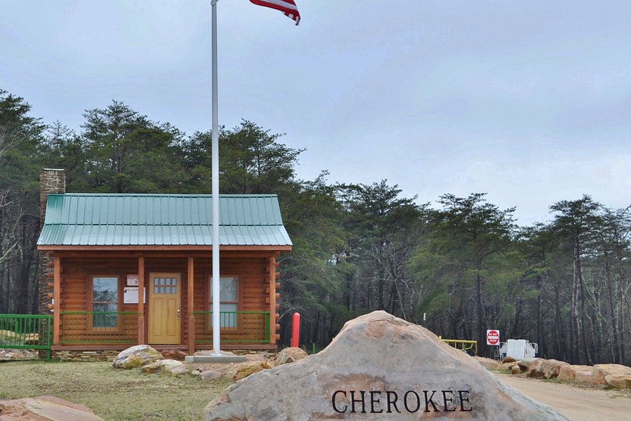
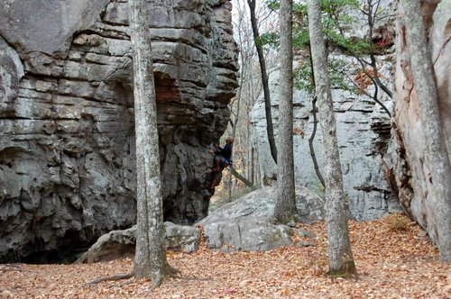
Cherokee Rock Village
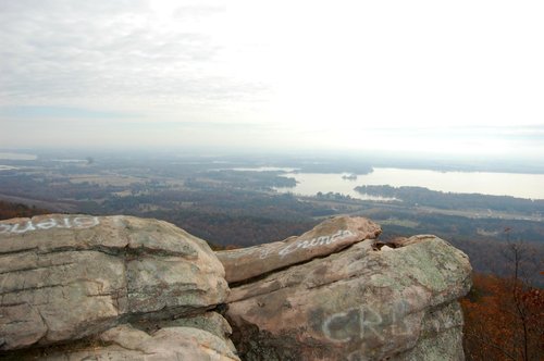
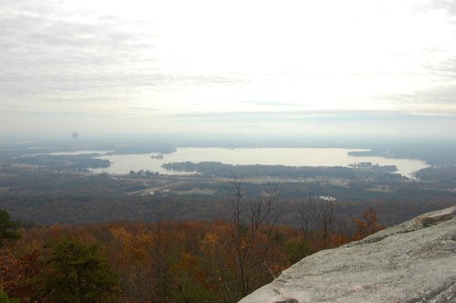
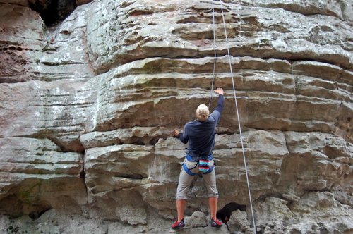
On a clear day, you can see as far as Rome, Georgia. Native Americans used this area for ceremonies until 1838, Today , this Cherokee County park is one of Alabama's most popular rock climbing areas, drawing climbers from around the Southeast. It is suited for beginner to intermediate climbers. Primitive camping is available. For nature lovers, who are not climbers, you can still climb up and down some of the boulders just for the fun of it or to enjoy the awesome view !
Address
2000 County Road 70, Leesburg, Alabama, United States, Postal Code: 35983-4085.
Mobile
Website
http://ccparkboard.com
Working hours
Monday : 12:00 AM - 11:59 PM
Tuesday : 12:00 AM - 11:59 PM
Wednesday : 12:00 AM - 11:59 PM
Thursday : 12:00 AM - 11:59 PM
Friday : 12:00 AM - 11:59 PM
Saturday : 12:00 AM - 11:59 PM
Sunday : 12:00 AM - 11:59 PM
Current local date and time now
Thursday, May 09, 2024, 0:03
User Ratings
4.5 based on (45 reviews)
Reviews
-
4clpayne 5:00 PM Nov 13, 2021
Unique afternoon with great views!
Spent 3 or so hours exploring the park. Neat park climbing around the various rock formations and like others have said some great views of Lake Weiss and the river below. Visit on the weekend if you want to watch the rock climbers. Worth spending some time watching their escapades! Had hoped for a long mileage day and planned on hiking the Diamond Trail. Various accounts online say this trail is 12-14 miles out/back round trip. The ranger at the park entrance said I'm new and had no clue where the Diamond Trail was. She hadn't heard of it and it's not listed on the paper map she provided or the online map. Go all the way to the end where it says dead end. There will be a sign on your left with a kinda sorta map. We went about a mile in and turned around. Terribly over grown and hadn't seen any rock formations (primary reason we came) so opted to turn around. Went in search of the colored trails listed on the map. The map unfortunately SUCKS! Park by the playground. To the right of the equipment there are entrances to the trails. Just hop in and start exploring. Don't bother trying to follow the map or a particular trail color. Just explore! Don't think you could really get lost. You'll just get frustrated trying to follow the map and/or trail markers (or lack of!) . We finally quit and just "winged it". Great experience! If you see a knook and cranny go explore it. You just never know where it may lead! Take a picnic and find a high rock to soak up the view and the sun while enjoying your lunch or your snack. Pet friendly, but much of the exploring is likely not for a small dog or older inexperienced dog. If you are only looking for highlights than not a problem for any dog. Not able to climb rocks? Afraid of heights? There are some great views if you walk along the edge from the playground/pavillion area back towards the office including a platform viewing area. Clean bathrooms and showers. Probably deserved a 3.5* rating due to TERRIBLE map and lack of trail markers. Went with 4*, though, due to uniqueness of venue, clean trails and great views!
-
4Jimmy T 5:00 PM Jan 23, 2021
Nice place to hike.
It was a lovely place to hike, though a majority of the trails were overgrown this time of year. The only concern I had was the security cameras in the men's and women's bathrooms. It was just something I was accustomed to, so I hope you're not shy if you need to go.